by Wessel Wessels | Oct 21, 2020 | General
The Stratosphere – Defining Earth’s Second Atmospheric Layer And Its Characteristics The Stratosphere – Defining Earth’s Second Atmospheric Layer And Its Characteristics The Earth’s atmosphere consists of five layers, each with its own distinct characteristics....
by Wessel Wessels | Oct 17, 2020 | General
Facts About The Mesosphere – What It Is And Its Defining Characteristics Facts About The Mesosphere – What It Is And Its Defining Characteristics Earth’s atmosphere consists of five layers, each with its own distinct features. The mesosphere is the third layer,...
by Wessel Wessels | Oct 12, 2020 | General
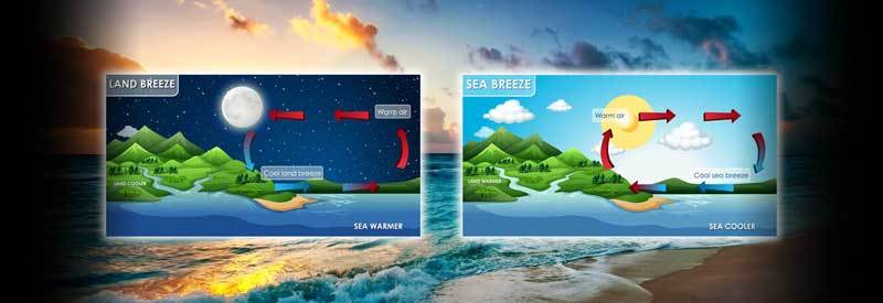
Land And Sea Breezes – What They Are, And The Differences Between Them Land And Sea Breezes – What They Are, And The Differences Between Them Most readers have heard of a land or sea breeze during weather forecasts discussing coastal conditions. But what precisely are...
by Wessel Wessels | Oct 5, 2020 | General
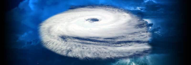
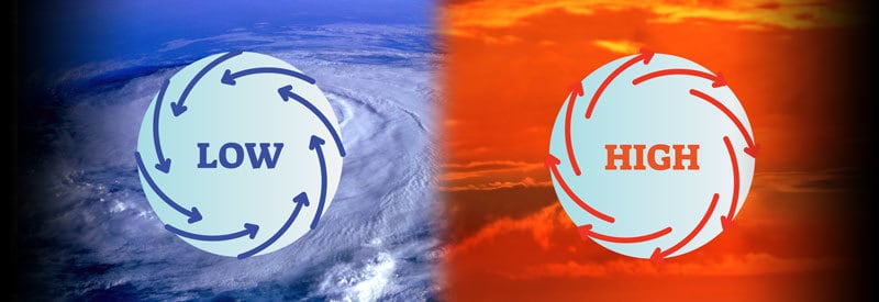
Cyclones And Anticyclones: What Is The Difference? Cyclones And Anticyclones: What Is The Difference? Most readers are familiar with the term “cyclone,” but not with the term “anticyclone.” We take a closer look at cyclones and anticyclones and their differences. A...