The Difference Between A Hurricane, Typhoon, And Cyclone
What Is The Difference Between A Hurricane, Typhoon, And Cyclone?

Most of us are very familiar with the terms “hurricane, typhoon, and cyclone.” It’s easy to think of these storm systems as completely different meteorological events, but this is far from the truth.
The Actual Difference Between A Hurricane, Typhoon, And Cyclone
As already briefly mentioned in the introduction, a hurricane, typhoon, and cyclone are all different names for exactly the same type of storm system.
They all start to form in the warm waters of the tropical and subtropical oceans, where vast amounts of humidity provide the fuel for what will eventually become one of these devastating storm systems. They also have exactly the same characteristics.
Then why are these large storm systems given different names?
A Hurricane, Typhoon & Cyclone Are Defined By Their Location
![]()
All three weather events don’t get their different names as a result of any specific characteristic or behavior, but due to where on the planet they occur. It is all about their location:
Storm System Naming Based On Ocean Region
The term “hurricane” is used when the weather system originates over the Atlantic Ocean, the Caribbean, or the Northeast Pacific Ocean.
The term “typhoon” is used when the weather system forms over the Northwest Pacific Ocean.
The term “cyclone” is used when the weather system originates over the South Pacific Ocean or the Indian Ocean.
Meteorologists officially use the umbrella term “Tropical Cyclone” to cover all three systems regardless of their location.
It also has to be pointed out that the terms hurricane, typhoon, and cyclone are only used once the system reaches tropical storm strength or higher.
Tropical Cyclone
The general term, tropical cyclone, is used by meteorologists and climatologists to describe the organized, rotating cloud systems and thunderstorms that form over the world’s tropical and subtropical oceans. They are easily identifiable by the familiar rotating cloud pattern spiraling outward from the center, as seen on satellite images.
They are also characterized by high wind speeds and extremely low pressure close to the center of the storm, with a typical low-level circulation allowing it to draw and maintain its energy from the warm ocean water.
It is interesting to note that the direction of rotation of a tropical cyclone differs between the Southern and Northern Hemispheres. In the Northern Hemisphere, it rotates in a counterclockwise direction, but in a clockwise direction in the Southern Hemisphere. This is all a direct result of the Coriolis Effect.
With all the technicalities out of the way, we can start looking in more detail at a hurricane, how it forms, and what its characteristics are.
Since most of us are familiar with the term “hurricane,” I am going to simplify everything. For the remainder of the article, the term “hurricane” will be used as the umbrella term for all three variations (hurricane, typhoon, and cyclone). The description of its formation and characteristics will apply to the other two name variations as well.
The Formation Of A Hurricane (Typhoon/Cyclone)
There are several stages in the development of a hurricane, each having its own classification based on strength. The best way to understand this process is to start with the weakest system, then work our way up as its strength increases.
Before delving into the formation of this meteorological event, we first need to define exactly what a hurricane is:
Definition Of A Hurricane

A hurricane is a strong, widespread tropical cyclone that starts as a tropical depression in the warm waters of the tropical and subtropical oceans. It is characterized by heavy rainfall, thunderstorms, and strong winds rotating counterclockwise in the Northern Hemisphere and clockwise in the Southern Hemisphere. A hurricane is declared once wind speeds reach 120 km/h (75 mph) for a sustained period.
1) It All Starts With A Tropical Depression
The first system that starts forming over the warm waters of the tropical and subtropical oceans is a tropical depression.
A tropical depression forms when the warm air over the ocean rises, leaving less air near the surface (forming a low-pressure system). The air that takes its place warms up and starts rising, too. The process continues, and the surrounding cooler air swirls in to take its place. The warm, moist air cools down as it rises, and clouds start forming as a result. This whole cloud system slowly rotates and grows as the warm air rising from the ocean’s surface continues to feed it. As long as the wind speeds do not exceed 38 miles per hour, the system remains a tropical depression.
2) Turning Into A Tropical Storm
![]()
As soon as sustained winds reach 39 miles per hour and above, the system is classified as a tropical storm. Within a tropical storm, wind speeds can vary from 39 – 74 mph.
We already discussed the tropical storm in detail earlier in the article, so I don’t need to add too much additional information in this section.
Clearly, a tropical storm is much stronger than a tropical depression as a result of the higher wind speeds. Even though it’s not yet seen as a hurricane, its destructive nature should not be underestimated. It can still lead to substantial damage and flooding, especially in coastal and surrounding areas.
(Also, take note that although these storms rotate counterclockwise in the Northern Hemisphere and clockwise in the Southern Hemisphere, they remain exactly the same in every other aspect.)
3) A Hurricane Is Formed
![]()
As the wind speeds increase, so does the strength of the storm. Once the wind speed reaches and exceeds 75 mph for a sustained period of time, it is classified as a hurricane.
The familiar shape of this weather system becomes much more defined, with a dense bank of rotating clouds surrounding the eye, clearly visible. The signature bands of clouds, spiraling out from the storm center, can spread as far as 100 miles or more in major hurricanes.
The eye of the hurricane sits in the middle of the storm system and is normally very clear and calm, with no cloud cover or any significant air movement. It is mostly circular in shape but can vary and often become more oval. The average size of the eye is about 15 miles (24 km), but in large hurricanes, it can be as big as 40 miles (64 km) or more.
The eye is surrounded by huge banks of clouds receding with height (in what is sometimes referred to as the “stadium effect”). Also called the eyewall, it is the clouds at the edge of the eye that contain the highest and most destructive wind speeds.
(This is one of the hidden dangers of a hurricane. People unfamiliar with hurricanes do not realize that the threat is not over once the first wave of the storm has passed and the eye moves in over a region.
This creates the false impression that the danger is over, causing many people to leave the safety of their shelters, only to be caught off-guard and hit by the destructive winds and rain in the approaching opposite side of the storm.)
The diagram below illustrates the internal structure of a fully developed hurricane:


Levels Of Strength
It goes without saying that the impact of these storm systems can be devastating, especially as it approaches and cross the coastline and surrounding areas.
As a hurricane moves inland, it loses power quickly, as it is no longer receiving energy from the warm ocean water. It can still cause severe damage, though, depending on the size and strength of the storm as it makes landfall.
The strength of the hurricane can be measured on a scale from 1 to 5. As you will see from the diagram below, the strength and resulting damage are mainly a direct result of the associated wind speeds. The diagram is based on a scale known as the Saffir–Simpson Hurricane Wind Scale.

Hurricane Category Based On Strength With Associated Wind Speed And Storm Surge
The strength of a hurricane is not the only factor that determines its impact and the amount of damage it will cause.
For example, two hurricanes can interact and combine to form a much stronger storm system. This phenomenon is called the Fujiwhara Effect.
Damage Caused By Hurricanes
Unfortunately, whenever a hurricane-strength storm makes landfall (or even while still over the ocean), a certain level of destruction is almost guaranteed.
The amount of damage caused is not just determined by the size of the hurricane but also to a large degree by the topography of the region it hits and also the population density of the affected area.
If the hurricane crosses into a coastal region that is very mountainous or has plenty of hills and valleys, the storm system gets disrupted and broken up fairly quickly, limiting the amount of damage it is able to inflict.
When the area the storm is entering is a very flat coastal region, the hurricane is able to travel much further inland without losing too much strength, causing the extent of damage to stretch further inland as well.
The amount of damage a hurricane can cause also depends on which component of the storm system is causing the damage. The main components of a hurricane that cause the most damage are:
- Rainfall,
- Wind Speed
- Storm Surge
By looking at each one of these components individually, one can get a better idea of the type and extent of damage that each one can cause.
1) Rainfall
![]()
Probably one of the most devastating results of the heavy rainfall associated with a strong hurricane is flooding. Extensive flooding can cause loss of life, not only as a result of drowning but also due to structural damage to buildings and other structures that can collapse and cause fatalities.
The damage to roads, bridges, and other infrastructure may run into hundreds of millions and can also make an area uninhabitable for months or even years in a worst-case scenario.
In mountainous areas with little vegetation for cover, mudslides and rockfalls are common occurrences during heavy rainfall. Heavy rainfall can also destabilize hillsides near roads and villages, which can lead to large-scale evacuations and roads becoming unusable.
2) Wind Speed
Depending on the strength of the wind, objects like trees and buildings can be severely damaged, or in some cases, completely flattened.
Consistent strong wind gusts can also worsen the effect of flooding and storm surge. It can drive floodwaters deeper inland, extending the damage caused by flooding. The strength and height of the storm surge will also be impacted by the wind speed, which will have a direct impact along the shoreline hit by a hurricane. This brings me to the last component of a hurricane that can be the most destructive part of a hurricane.
3) Storm Surge
![]()
We have all heard about this term when hurricanes or related storms are discussed or mentioned during weather forecasts. So let’s first clarify what exactly a storm surge is.
Storm surge can be seen as the abnormal rise in sea level as a result of a hurricane, where both the low-pressure system in the center of the storm, as well as the high wind speeds, cause a rise in water levels. The storm surge dramatically builds up in height as the ocean floor becomes shallower near the shoreline as the hurricane approaches coastal regions.
The height of a storm surge is determined by
-
- the drop in air pressure
- the strength of the wind speeds
The strength of the low-pressure system has a very significant impact on the height of the storm surge while still over the ocean. The lower the air pressure, the higher the sea level will rise. It is estimated that for every drop in one hPa (1 millibar) of pressure, the sea level rises by approximately 0.4 inches (10 mm).
(If you take into consideration that the normal air pressure at sea level is about 1013 millibars and the pressure in a hurricane was measured as low as 882 millibars in 2005, the huge impact that air pressure in hurricanes has on ocean levels speaks for itself.)
The high winds blowing in the direction of the shore contribute to the rise in sea levels as they cause a build-up of water in the direction the wind is blowing. It also strengthens and drives the resulting high waves hitting the coast, forcing the water deeper inland.
The results of storm surge can be devastating, especially during very strong hurricanes when waves of 15 – 20 feet or more can be generated.
(Hurricane Katrina generated a storm surge of 28 feet in Louisiana in the United States in 2005. You only need to Google the term “Hurricane Katrina” to see images of exactly how devastating a storm surge can be…)
(If you want to see how the size of a hurricane and related wind speeds influence the size of the storm surge, simply have a look at the Hurricane Strength Diagram earlier in the article.)
What can make the effect of storm surge even worse is when a storm tide forms.
A storm tide occurs when a coastal region is already experiencing the natural high tide when the storm surge breaches the shoreline. The normal high tide level may already be 3 feet above mean sea level. When a storm surge of 12 feet reaches the shore, it creates a storm tide that is a combined 15 feet high. (The high tide sea level and height of the storm surge are combined to form the massive influx of water.)
Clearly, the areas most affected by a storm surge are towns and cities situated on the coast. The closer to the shoreline, the more severe the damage will be. It is not uncommon for buildings and other structures close to the shore to be completely destroyed by the surge and waves.
This “wall of water” and the resulting flooding can spread far inland, enveloping entire cities and surrounding areas, depending on the size of the hurricane. While this is happening, violent waves, driven by the high wind speeds, will continue to batter the coast and cause damage to anything that wasn’t destroyed by the initial hit of surge and waves.
How To Recognize And Identify An Approaching Tropical Cyclone
Although tropical cyclones form and develop long before they can be observed by any individual (and are normally tracked via satellite and other advanced meteorological equipment), there are some indicators that one is approaching:
1. Long-Period Ocean Swell
These swells typically form far offshore around 24-48 hours before landfall and are more powerful and sustained than normal coastal waves. Rip currents also increase significantly before the storm arrives.
2. Falling Barometric Pressure
A steady, noticeable drop in surface pressure that accelerates 12-24 hours before landfall, which can show up on home barometers, is also a strong indicator.
3. Increasing Sustained Winds
Wind speeds increase gradually over hours, even up to a day, before the storm itself arrives and becomes directionally more consistent as the circulation gathers strength.
4. Outer Rain Bands
The rain itself arrives in rotating bands, which become more frequent and intense closer to landfall. It is characterized by heavy squalls followed by temporary lulls, with the wind direction shifting slightly between bands.
5. Change in Cloud Structure
High cirrus clouds often appear first, spreading outward from the storm. As the bands move in, the sky gradually becomes overcast as thicker cloud bands approach. The cloud movement appears organized and consistent in direction.
6) The Eye (If Direct Hit Occurs)
There is sudden calm and clearing after intense wind and rain pass over, which is also when the air pressure reaches its lowest point. As the opposite eyewall arrives, the wind direction reverses, and conditions may become equally or more severe after the calm period.
Please note that these indicators appear well after a potentially dangerous storm has already formed, and paying attention to weather forecasts and official warnings is critically important.
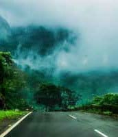
Monsoons
![]()
The sheer power and scale of hurricanes cannot be overemphasized enough or taken lightly in any way. There is a reason why national weather services and weather forecasts pay so much attention to approaching hurricanes.
By now, you should have a very clear idea of what hurricanes/cyclones/typhoons are, as well as their differences (or similarities). We also examined how they are formed, their characteristics, and the impact they have on the environment.
Now you must forget everything you just read, for the moment anyway. The reason is simple. The weather occurrence I am about to discuss is an entirely different animal from all the terms discussed in the above section, which, in more ways than one, actually refer to precisely the same meteorological phenomenon.
The term “monsoon” is sometimes confused with a hurricane, cyclone, and typhoon since they are all devastating weather events that occur over large regions.
While the other terms refer to the same phenomenon, though “monsoon” refers to a completely different type of weather system…
First of all, a monsoon is not a random event that occurs sporadically at different locations. It is a seasonal event that only occurs during the rainy season in specific regions on the planet (predominantly the region stretching from India to Southeast Asia).
Secondly, the way in which a monsoon is formed, as well as its characteristics, differs entirely from the typical hurricane formation and its familiar “rotating and spiraling” shape.
So what exactly is a monsoon, and how does it develop?
What Is A Monsoon?
A monsoon is the weather pattern that forms over Southeast Asia, specifically India, during the warm summer months. It is caused by southerly winds moving in from the high-pressure system over the warm Indian and Western Pacific Oceans. These winds pick up a substantial amount of moisture from the warm ocean water as they move north towards the low-pressure system present over the continent, bringing with it large torrential rains.
(Just in case you came across the term or may have been wondering, there is such a thing as a winter monsoon. This type of monsoon is characterized by the air flowing in the opposite direction to the airflow during warm summer months.
It is also associated with the resulting dry weather condition that prevails over land during the winter. As a result, whenever a general reference to a monsoon is made, it normally refers to the familiar large-scale system occurring during the summer over Southeast Asia.)
Please note that a similar weather system occurs over the Southwestern United States (as well as West Africa) during late summer, which is technically also a monsoon. These systems are much weaker and smaller than the ones occurring in Southeast Asia.
Although they are all technically monsoons, the general reference to “monsoons” and “monsoon season” in global terms is generally associated with the vast weather system in India and Southeast Asia.
Early Stages And Development Of A Monsoon
It is not wrong to think of a monsoon as a gigantic sea breeze. Instead of occurring over the course of a day, however, it lasts for months. It also affects a vastly greater region than just a coastline, as a single monsoon can cover large parts of India or Southeast Asia at a time.
(The principal mechanisms driving a sea breeze apply to a monsoon as well, though.)
During the summer, both the land and ocean heat up, but (due to each one’s different capacity to absorb and retain heat), the land warms up much quicker than the ocean waters.
As the land heats up more quickly, it also warms the air at the surface. The warmer air starts to rise, which leaves less air at the surface, creating a low-pressure system over land.
The water over the ocean takes much longer to warm up, allowing the air above it to maintain a higher pressure. Since air always flows from a high-pressure to a low-pressure system, the wind blows from the ocean to the land.
The result is very similar to a sea breeze. This “sea breeze” effect does not occur over the course of a day, though, but builds up and lasts for months. It can last for the full duration of the summer season (or however long the region experiences warm weather).

The air flowing in from the ocean is filled with moisture. As the air reaches land, it starts to rise, and as it gains altitude, it cools down. The cooler air can no longer hold the moisture, and condensation takes place. This, in turn, leads to large-scale precipitation over the region.
The colder air moves back over the ocean. This completes the cycle of airflow that creates the structure of a monsoon. (During the winter months, this whole cycle takes place in reverse, leading to the dry weather the region experiences during winter)
Monsoon rains have been part of Southeast Asia and India for centuries and are generally seen as a normal seasonal weather cycle, occurring every summer season. (It is not classified as an abnormal weather activity.)
The Dangers Of A Monsoon
For the most part, the agricultural sectors of the regions affected by monsoons have adapted to this weather pattern over time. In fact, the whole agricultural economy now relies on monsoon seasons and plans its activities around the rainfall during this time.
That does not mean a monsoon does not come without its dangers, though. Some of these dangers are a direct consequence of a monsoon, but some are more hidden, indirect dangers. It can be roughly divided into three categories.
1) Heavy Rains And Flash Flooding
The cloud systems that build up over land when a monsoon forms carry a vast amount of moisture. It usually results in heavy, sustained rains.
Often, though, a very large downpour results in a sudden buildup of water, which causes flash flooding throughout the region. Many lives are lost due to drowning or the collapse of structures weakened by floodwaters.
What makes flash floods so dangerous is that they don’t just occur rapidly and without warning, but the buildup of water levels also happens very quickly. It leaves people very little time to respond, and the quick-rising water often traps victims.
2) Diseases
A more indirect but far more devastating result of the monsoon season is the development and spread of waterborne diseases.
Standing water, caused by the persistent rain and flooding, is a breeding ground for all kinds of waterborne diseases and causes thousands of fatalities each year.
Malaria, cholera, typhoid, dengue, and viral fever are just a few of the potentially deadly diseases that are associated with the rainy summer season in Southeast Asia.
They are all directly or indirectly associated with the monsoon season and can be transmitted in a variety of ways:
- Bathing in contaminated water
- Contact with infected bodily secretions
- Eating contaminated food
- Insect bites, especially mosquitoes
- Drinking contaminated water
Precautions, advances in medical technology, and access to treatment have lessened the effect of these diseases in recent years. However, they remain the biggest cause of death as a result of monsoons in the subcontinent.
3) Late Arrival Or Weak Monsoons
Ironically, as destructive as the monsoon rains can be, the lack or delay in the arrival of these rains can be just as devastating. For more than a century, farmers and the agricultural industry as a whole have not only adapted but plan and rely on the coming monsoon rains for the irrigation of crops and, to a smaller degree, grazing for livestock.
A monsoon season that arrives a few weeks late can have a severe effect on the growth and success of Kharif (rice, Jowar, maize, etc. planted at the beginning of the rainy season) crops. A whole season with very low monsoon rainfall can lead to complete crop failure.
Take into consideration the fact that 70% of India’s population relies on agriculture, and 58% of the country’s employment comes from the agricultural sector. It highlights the importance of a monsoon season with enough rainfall across the whole subcontinent.
Water storage and better forms of irrigation helped ease the problem over the short term, but are still not enough to shield the industry from a dry monsoon season.
Conclusion
This article highlighted and clearly illustrated the difference between a hurricane, typhoon, and cyclone. It showed how these different weather events are, in fact, all one and the same meteorological phenomenon.
We also focused on the formation, growth, and characteristics of a hurricane to illustrate how these destructive storm systems develop.
Until next time, keep your eye on the weather!