Wessel Wessels

Author Archives: Wessel Wessels

Lifelong weather enthusiast and researcher. Interested in all things weather-related, and how global climate and local weather interact. Owner of multiple home weather stations for almost two decades, but still learning and expanding his knowledge base every day. He is dedicated to sharing his expertise and knowledge to get more people involved and interested in both their local and global weather and how it interacts with climate on a worldwide scale. Love sharing my knowledge on home weather stations, how they work, and the many ways you can use them to your advantage. All in all, he is just a bit of weather nerd.

Fallstreak Holes: What They Are And How They Form

Fallstreak Holes - What They Are And How They Form

Certain meteorological events, specifically cloud formations, often have unique but also puzzling characteristics. Fallstreak holes are one such occurrence, but what are they, and how do they form?

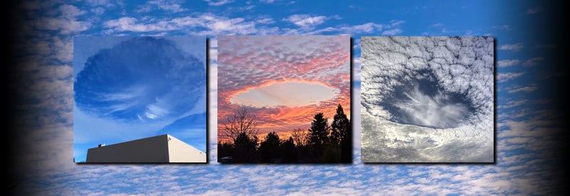
Fallstreak holes are large circular or oval-shaped openings that form in cirrocumulus or altocumulus clouds when supercooled water is turned into ice crystals, causing the surrounding water droplets to evaporate. This occurrence is predominantly the result of aircraft passing through a cloud.

If you found yourself at the right time and place, you may have been in the unique position of observing what looked like a large appearing what seems to be spontaneously in a cloud formation.

These appearances may look very unnatural and are often confused with Unidentified Flying Objects (UFOs) or other artificial objects. Although they may seem artificially created objects, it is the result of a natural process, which was initiated by a manmade object.

In the following sections, we take a closer look at what fallstreak holes (also known as punch hole clouds) are and how they develop.

What Are Fallstreak Holes?

Before taking a more detailed look at how fallstreak holes develop, one needs to establish a more elaborate and detailed look at the definition and characteristics of this phenomenon. 

Fallstreak Hole Definition

What Are Fallstreak Holes

Fallstreak holes are large circular or oval-shaped openings that form in cirrocumulus or altocumulus clouds when supercooled water is turned into ice crystals, which also causes the surrounding water droplets to evaporate. 

This occurrence is predominantly caused by aircraft passing through the clouds, which triggers the formation of ice crystals and the evaporation of water droplets behind it.

Also known as punch hole clouds, cavum, skypunch, or canal clouds, these meteorological phenomena predominantly occur in mid to high-level clouds such as altocumulus or cirrocumulus clouds at heights of 3 -12 kilometers (2 - 7 miles)

At these high altitudes, clouds primarily consist of supercooled water, which creates the perfect environment for the development of fallstreak holes. 

As already mentioned, the development of these phenomena is primarily caused by aircraft as they pass through high-level clouds. Exactly how this occurs will be discussed in detail in the upcoming section.

Although fallstreak holes normally take the shape of a circle or oval, they can also develop in other forms, specifically cigar-shaped forms. This can be attributed to the angle at which an aircraft passes through a cloud.

A circular or oval-shaped hole is typically the result of an airplane passing through the cloud at an acute angle. When the approach through the cloud is more shallow, though, the aircraft spends more time in the cloud, which results in the cigar-shaped hole.

How Fallstreak Holes Develop

How Fallstreak Holes Develop

The following list details the development of fallstreak holes, starting with the conditions that need to be in place to make their formation possible:

  1. 1
    For fallstreak holes to form, altocumulus or cirrocumulus clouds must be present, which have both the right appearance and are situated at the appropriate altitude, creating the right environment for the second requirement to form.
  2. 2
    This allows for the presence of supercooled water, the second requirement. (Supercooled water is water droplets that dropped below freezing point but are still in liquid form due to the absence of a nucleus for ice crystals to form around.) 
  3. 3
    Since ice crystals need nuclei like microscopic dust or pollen particles to form on or drop below -40° Celsius (-40° Fahrenheit) to spontaneously develop, supercooled water in the mid to upper-level clouds needs another impetus to freeze.
  4. 4
    An aircraft passing through the clouds provides this impetus. The wings or propeller blades force the air in its wake to expand, causing it to cool down in the process. This drop in temperature is enough to allow ice crystals to form.
  5. 5
    As ice crystals with enough weight form behind the aircraft, it falls to the ground, creating an opening where the plane passed through.
  6. 6
    This process also causes surrounding ice crystals to form, which generates enough heat (as a result of the Wegener–Bergeron–Findeisen process) to cause a domino effect where the surrounding water droplets start to evaporate.
  7. 7
    The combination of ice crystal formation and the evaporation of water droplets allows for the opening to expand rapidly, resulting in the large hole we view from the surface as fallstreak holes or punch hole clouds.
  8. 8
    Depending on the angle at which the aircraft passes through the clouds, the shape of a fallstreak cloud can vary from circular or oval to cigar-shaped.

Conclusion

Although fallstreak holes may appear very unnatural, there is a perfectly logical explanation for their development, as this article clearly illustrated. 

Actually, they are a combination of a natural process combined with an artificial object. The natural mechanisms involved in the formation of ice crystals and the evaporation of water droplets are initiated by an artificial object in the form of an aircraft passing through clouds.

Never miss out again when another interesting and helpful article is released and stay updated, while also receiving helpful tips & information by simply  clicking on this link .

Until next time, keep your eye on the weather!

Also Read

Noctilucent Clouds: Defining Night Shining Clouds And How They Form
Certain cloud formations can result in some of the most awe-inspiring and spectacular events nature occasionally puts on display. We[...]
Mother Of Pearl Clouds: Explaining The Appearance Of Nacreous Clouds
An observer once commented that "once seen are never forgotten," referring to a rare, awe-inspiring meteorological phenomenon called Nacreous Clouds[...]
Cap Clouds – What They Are And How They Differ From Lenticular Clouds
Most clouds develop as a result of atmospheric conditions like wind, temperature, and moisture. However, certain clouds form due to[...]

Defining Mammatus (Or Bubble Clouds) And How They Form

Bubble Clouds

Certain cloud formations always manage to put on a striking display, but Mammatus (Bubble) clouds look almost ominous and threatening. But what are these cloud types, and what are their characteristics?

Mammatus clouds are visually striking pouch-like structures that typically form below the base of a cumulonimbus cloud formation. They form as a result of cold sinking air and predominantly consist of ice. They pose no threat themselves but can serve as a precursor for adverse weather conditions.

It is very hard not to notice this unique cloud formation with its pouch-like protrusions extending from the base of a storm cloud. Their unique appearance also makes it easy to distinguish them from other cloud types.

But what exactly are these meteorological phenomena, what causes their very recognizable shape and features, and are they really as dangerous as they appear?

We examine exactly what mammatus clouds are, how they form, as well as the characteristics and features that define them.

What Are Mammatus Clouds?

Before one can start taking a closer, more in-depth look at the characteristics of mammatus clouds and the potential ways in which they develop, a more detailed definition of this phenomenon is required:

Mammatus Cloud Meaning

What Are Mammatus Clouds

Mammatus clouds are pouch-like protrusions (or sacs) that form below the base of a cloud formation, predominantly cumulonimbus clouds. They are the result of cold sinking air and predominantly consist of ice. 

These formations can stretch for hundreds of miles (or kilometers), and although they pose no threat themselves, they are commonly associated with adverse weather conditions like thunderstorms and tornadoes.

The word "mammatus" is derived from the Latin word "mamma," which translates to "breast" or "udder." This is a very apt description, especially when looking at the physical appearance of this cloud formation.

As the title alluded to, mammatus clouds are informally or more commonly known as bubble clouds due to their appearance. It is officially known as mammatocumulus.

Technically, mammatus clouds are not individual types of cloud species. Rather, it is an extended feature of the cloud at which base it develops.

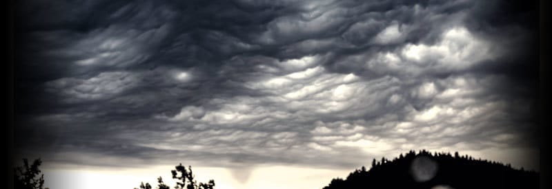
mammatus clouds

Although they are predominantly associated with storm clouds like cumulonimbus, they can also form at the base of other types of clouds like altostratus and stratocumulus. They are also known to form at the base of volcanic ash clouds.  

Mammatus clouds can spread out over hundreds of miles during a single event. Although the multiple clusters of lobes that constitute this formation can last anything from 15 minutes to a couple of hours, a single lobe typically lasts for an average of 10 minutes.

What makes mammatus clouds especially unique is not their appearance but rather their development, which is the inverse of normal cloud development. Clouds typically form when rising moist air reaches dew point, condensation occurs, which leads to cloud development.

On the contrary, mammatus clouds form as a result of sinking cold air that has enough momentum to continue descending until it passes through the cloud base of a cumulonimbus cloud and develops below it in the familiar "pouch-shaped" structures.

Mammatus Clouds Formation

A few common facts are known about mammatus cloud formation. We know that they form underneath the base of cloud formations, predominantly cumulonimbus clouds.

They also typically form in the presence of unstable air conditions where cold sinking air is directly responsible for their development. (Due to these unstable air conditions associated with these clouds, pilots keep their aircraft well clear of any mammatus cloud development.)

Apart from these well-established facts, very little is actually known about how these unique clouds form. There is much debate about their origin, and although many theories are in circulation attempting to describe their formation, most are principally flawed.

mammatus cloud development

Illustration showing where mammatus structures develop in a cumulonimbus cloud formation.

The predominant theory that is most widely accepted is proposing that saturated cold air in a cumulonimbus starts to spread out once it reaches the tropopause, where temperature inversion prohibits it from rising any further.

As a result, it starts to spread out horizontally in the anvil part of the cloud. The saturated air is heavier than the surrounding dry air and starts to descend. If enough momentum is present for the air to continue its descent, it emerges as mammatus below the cloud base.

The bottom line is that there is no clear explanation for mammatus cloud development, and their origins remain a mystery.

Mammatus Clouds Facts

Some of the information in this section already appear elsewhere in this article and are explained in more detail, but the following list highlights the key facts and characteristics that define mammatus clouds:

  1. 1
    Mammatus clouds are pouch-like structures that typically form below the base of a cumulonimbus cloud formation.
  2. 2
    They are the result of cold sinking air and predominantly consist of ice.
  3. 3
    Although many theories and hypotheses exist, their development remains largely unknown.
  4. 4
    Although they appear ominous and threatening, mammatus clouds pose no threat themselves.
  5. 5
    Since they predominantly appear at the base of cumulonimbus clouds, they are associated with adverse weather conditions like thunderstorms, hail & tornadoes.
  6. 6
    Contrary to popular belief, mammatus clouds do not result in the formation of tornadoes.
  7. 7
    The multiple clusters of lobes that constitute mammatus formations can stretch out over hundreds of miles.
  8. 8
    A mammatus cloud formation can last anything from 15 minutes to a couple of hours, but a single lobe only lasts an average of 10 minutes.
  9. 9
    Although predominantly associated with cumulonimbus clouds, mammatus formations can also be found at the base of other cloud types like altocumulus, altostratus, and cirrocumulus clouds.
  10. 10
    Mammatus clouds can also form underneath ash clouds during a volcanic eruption and have even been known to develop in the contrails of jet airliners.
  11. 11
    In contrast to regular cloud development, which is the result of rising warm air, mammatus clouds are the result of cold sinking air.
  12. 12
    These unique cloud formations have been a favorite subject for photographers and artists alike, and paintings of mammatus clouds date back to the 1500s.

Although by no means an exhaustive list of all aspects involving this meteorological phenomenon, this list captures the most important defining characteristics of mammatus cloud structures.

Conclusion

It is clear that mammatus clouds are some of the most unique and fascinating cloud structures. Their large pouch-like protrusions make them look ominous and threatening, but as this article illustrated, they are completely harmless themselves.

And although their origins remain a mystery and a source of much debate, it has been established that these upside-down formations are the result of cold sinking air and typically form underneath the base of cumulonimbus clouds.

This article defined what exactly mammatus (bubble clouds) formations are, highlighted their key characteristics, and also had a look at their development.

Never miss out again when another interesting and helpful article is released and stay updated, while also receiving helpful tips & information by simply  following this link .

Until next time, keep your eye on the weather!

Also Read

Noctilucent Clouds: Defining Night Shining Clouds And How They Form
Certain cloud formations can result in some of the most awe-inspiring and spectacular events nature occasionally puts on display. We[...]
Mother Of Pearl Clouds: Explaining The Appearance Of Nacreous Clouds
An observer once commented that "once seen are never forgotten," referring to a rare, awe-inspiring meteorological phenomenon called Nacreous Clouds[...]
Cloud Types And Their Significance In Weather Formation
Often, we briefly glance at the skies in the morning to see how cloudy it is before heading off to[...]

Noctilucent Clouds: Defining Night Shining Clouds And How They Form

Noctilucent Clouds

Certain cloud formations can result in some of the most awe-inspiring and spectacular events nature occasionally puts on display. We look at one such meteorological phenomenon known as Noctilucent clouds.

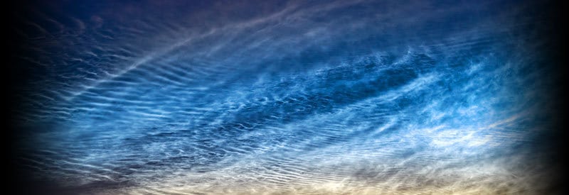
Noctilucent clouds are defined as high-level clouds forming after sunset at an altitude of approximately 80 km or 50 miles. Also known as night-shining clouds, they occur when sunlight below the horizon illuminates and reflects off ice crystals in the mesosphere, resulting in a blue or silver hue.

These cloud formations are not nearly as common as more familiar cloud types and can mostly be viewed at high latitudes during the summer months (during May-August in the Northern Hemisphere and during November-February in the Southern Hemisphere).

They are, however, of no less importance or any less spectacular. In fact, noctilucent clouds are often used by meteorologists to study wind movement in the upper atmosphere.

In this article, we take a closer look at the definition of noctilucent clouds, how they form, as well as the characteristics that define them.

What Are Noctilucent Clouds?

In order to understand how and why noctilucent clouds form and why they exhibit the characteristics that define them, one needs a more expansive and detailed definition of what precisely this cloud formation is:

Noctilucent Cloud Definition

What Are Noctilucent Clouds

Noctilucent clouds are high-level clouds that form after sunset (during astronomical twilight) at an altitude of approximately 76 - 85 km (47 - 53 miles) in the mesosphere. 

Also known as night shining or polar mesospheric clouds, they occur when the sunlight illuminates & reflects off ice crystals in the upper atmosphere, which results in the characteristic illuminated blue or silver color.

They can mostly be observed at high latitudes during the summer months (May-August in the Northern Hemisphere and November-February in the Southern Hemisphere).

The name "noctilucent" is derived from Latin words "nocto" and "lucent," which translates to "night shining" (A direct reference to the radiant characteristics of this cloud formation.)

Noctilucent clouds are also more commonly known as night shining clouds or polar mesospheric clouds. Their structure closely resembles the streaky or flaky characteristics of Cirrus clouds (another high-level cloud type).

They occur at an altitude of 76 - 85 km (47 - 53 miles) in the mesosphere, where it is too cold for water to remain in its liquid state, and ice crystals form on small dust particles, which are believed to be remains of meteors. (Meteors burn up in the mesosphere.)

Night Shining Clouds

The clouds are too faint to be visible during the day and only become visible after sunset when the sky is mostly covered in darkness. This allows ice crystals in the high-level noctilucent clouds that are still exposed to the sunlight to be illuminated.

Noctilucent clouds are typically observed at high latitudes (approximately 50 to 70 degrees north or south) since this is where temperatures in the mesosphere drop to below -120° Celsius (-184° Fahrenheit), which is a necessary condition for the clouds to form. 

An observer located at a high latitude on the planet's surface can view the illuminated phenomenon as cirrus-like cloud formations with a blue or silver hue.

(The blue color is a result of the absorption of ozone in the atmosphere.)

As the definition already eluded to, this cloud type is a fairly rare meteorological occurrence. The reason for this is the restrictive conditions that need to be in place for them to form and also be observed in the first place. We discuss them in the next section.

How Noctilucent Clouds Form

Noctilucent Clouds Formation

Diagram illustrating the formation of noctilucent clouds. Click on the image for a larger, more detailed view.

Noctilucent clouds are rare meteorological phenomena for a reason. The strict conditions necessary for their development only occur at certain latitudes & during specific times of the year. Noctilucent cloud formation occurs as follows, starting with the necessary conditions:

  1. 1
    Temperatures in the mesosphere need to be below -120° Celsius (-184° Fahrenheit) for noctilucent clouds to form.
  2. 2
    This means the clouds can only form during the summer (when solar radiation forces warm air to rise higher into the atmosphere and cool down further, resulting in the colder air in the mesosphere).
  3. 3
    For the same reason, an observer must also be located at a high latitude (approximately 50 to 70 degrees north or south), the location where temperatures in the mesosphere drop low enough.
  4. 4
    From an observer's perspective, the sun also needs to be below the horizon to allow a large portion of the sky to be covered in darkness. (Noctilucent clouds appear very faint and are impossible to view in daylight.) 
  5. 5
    If enough water vapor and dust particles are present in the air, noctilucent clouds form in the subzero temperatures. 
  6. 6
    Although the observer is already covered in darkness, sunlight from below the horizon still reaches the high-level noctilucent clouds situated at an altitude of approximately 80 km (50 miles).
  7. 7
    As a result, the sunlight illuminates the ice crystals in the clouds, which light is reflected back to the observer at the surface.
  8. 8
    The observer at the surface views the noctilucent clouds as cirrus-like clouds with a blue or silver hue. 

There are also other processes involved in the formation of noctilucent clouds, but this section highlighted the key steps involved in the development of this rare meteorological phenomenon. 

Facts About Noctilucent Clouds

Much of the information provided in this section has already been covered elsewhere in this article. However, the following list highlights the key facts that define and characterize noctilucent clouds:

  1. 1
    Noctilucent clouds are high-level clouds that form during astronomical twilight (after sunset).
  2. 2
    It occurs in the mesosphere at an altitude of approximately 76 - 85 km (47 - 53 miles).
  3. 3
    They have an illuminated blue or silver color hue as a result of sunlight reflecting off ice crystals.
  4. 4
    It consists of ice crystals that form on small dust particles, which are believed to be remnants of meteors (which typically burn up in the mesosphere.)
  5. 5
    The clouds only occur during the summer when temperatures in the mesosphere drop below -120° Celsius (-184° Fahrenheit), which is a requirement for the formation of noctilucent clouds. 
  6. 6
    Noctilucent clouds are typically observed at high latitudes (approximately 50 to 70 degrees north and south.)
  7. 7
    They are the highest clouds that occur in the Earth's atmosphere.
  8. 8
    In 2014, water vapor from the rocket boosters of a SpaceX Falcon 9 rocket resulted in the formation of noctilucent clouds over Florida, USA.
  9. 9
    The air in the mesosphere where noctilucent clouds occur is one hundred million times dryer than the air found in the Sahara desert.
  10. 10
    Noctilucent clients were first observed in 1885.
  11. 11
    Their blue color is a result of the absorption of ozone in the atmosphere.
  12. 12
    Although they occur in both hemispheres, noctilucent clouds have been observed thousands of times in the Northern Hemisphere compared to less than 100 in the Southern Hemisphere.
  13. 13
    Noctilucent clouds are also known as night shining clouds or polar mesospheric clouds.

This list does not cover every possible fact there is know about noctilucent clouds but highlights the most important ones.

Conclusion

Noctilucent clouds are not just some of the rarest meteorological phenomena on the planet, but their location in the mesosphere also makes them hard to study by meteorologists. (The location of the mesosphere makes it the hardest atmospheric layer to explore.)

This does not make them any less spectacular or stop scientists from studying them. After all, they have their own dedicated satellite observing them. NASA's AIM (Aeronomy Of Ice In The Mesosphere) satellite observes noctilucent cloud characteristics and behavior.

This article highlighted and defined what exactly noctilucent clouds are, how they develop, and the characteristics that define them.

Never miss out again when another interesting and helpful article is released and stay updated, while also receiving helpful tips & information by simply  clicking on this link .

Until next time, keep your eye on the weather!

Also Read

Arcus Clouds: What They Are And How They Form
Some cloud types appear in very distinct shapes and sizes. Arcus clouds are one such example, but these cloud formations[...]
Mother Of Pearl Clouds: Explaining The Appearance Of Nacreous Clouds
An observer once commented that "once seen are never forgotten," referring to a rare, awe-inspiring meteorological phenomenon called Nacreous Clouds[...]
Cloud Types And Their Significance In Weather Formation
Often, we briefly glance at the skies in the morning to see how cloudy it is before heading off to[...]

The Rainbow – A Meteorological Phenomenon That Knows How To Put Up A Show

Rainbow Facts

Rainbows are, without doubt, the most photographed and well-known meteorological phenomena on Earth. But what exactly are these events, how do they develop, and what causes their unique characteristics?

A rainbow is an optical meteorological event that occurs when water droplets in the atmosphere refract, reflect, and scatter sunlight into its spectral colors, appearing as a multicolored arc to the observer. It typically occurs with direct sunlight and raindrops simultaneously present in the sky.

Almost every human on the planet is familiar with the multicolored arc of a rainbow formation spanning across the sky. Even the few readers who never observed one have probably seen several images and illustrations of this meteorological phenomenon.

Although it usually occurs on a rainy day when the sun breaks through the clouds, it can also happen under similar conditions when water droplets in the air come into contact and transform sunlight.

This post examines what a rainbow is, how it is formed and looks at the different types of rainbows. It also highlights the key facts that define this meteorological phenomenon.

What Is A Rainbow?

Before one can start looking at the formation of a rainbow and the key facts that define it, one needs a more elaborate definition of the phenomenon. The introduction already provided a brief description, but a more comprehensive description of a rainbow:

Rainbow Definition

What Is A Rainbow

A rainbow is an optical meteorological phenomenon that occurs when water droplets in the atmosphere refract, reflect, and disperse sunlight into its spectral colors, which appear as a multicolored semicircular arc to an observer close to the horizon. 

A rainbow typically develops when direct sunlight and raindrops are simultaneously present in the atmosphere on opposite sides of the sky. Its appearance results from sunlight being reflected by water droplets at an angle of between 40° to 42° to the observer.

The word "rainbow" originated from the Latin word "arcus pluvius", which literally translates to "rainy arch."

A rainbow is a meteorological phenomenon that is, in fact, nothing more than an optical illusion. It is not an actual physical object and also has no physical location. It is simply light being reflected and dispersed that, under the right conditions, reach an observer's location.

It typically appears when raindrops are present in the air and are exposed to (usually) direct sunlight low on the horizon on the opposite side of the sky. This explains why rainbows normally appear in the west in the morning and the east in the late afternoon.

Rainbow

The multicolored arc one observes is a result of sunlight refracted and reflecting off the back of a water droplet, which also disperses the white sunlight and breaks it up into its seven spectral colors (red, orange, yellow, green, blue, indigo, and violet.)

Red (the color with the longest wavelength) bends at an angle of 42 degrees and appears on the outer edge of the bow, while violet (the color with the shortest wavelength) bends at an angle of 40 degrees and appears on the inner edge of the arc.

All rainbows are technically in the shape of a full circle, but since they occur so close to the ground, one only observes the arc visible above the horizon. The antisolar point, the theoretical center of a rainbow, is almost always positioned at a point below the horizon.

A rainbow and sun always appear on the opposite sides of the sky. As a result, when viewing a rainbow, an observer will always be standing with his/her back to the sun. (Sunlight travels past the onlooker, which gets reflected and dispersed by water droplets back to the viewer.) 

Rainbow Formation: How A Rainbow Develops

With a better understanding of what a rainbow is and the characteristics that define it, one needs to look at how a rainbow is formed to clarify why and how it occurs. The following steps detail the progression in the development of a rainbow:

Rainbow Formation

Illustration demonstrating the path of sunlight through a water droplet to explain the formation of a rainbow. Click on the image for a larger view.

  1. 1
    For a rainbow to develop, both water droplets as well as (direct) sunlight need to be present in the air.
  2. 2
    With the sun and water droplets situated on opposite sides of the sky, sunlight travels through the atmosphere until encountering and hitting the surface of individual water drops, typically in the form of a rain shower.
  3. 3
    Water has a different density than air. As a result, sunlight is bend (refracted) as it enters a water droplet. 
  4. 4
    Inside the droplet, the light also gets dispersed (broken up) into its spectral colors (red, orange, yellow, green, blue, indigo, and violet), which is responsible for the multicolored band of a rainbow.
  5. 5
    Dispersed light continues to travel through the droplet until it reaches the back of the water drop, where it gets refracted and reflected at an angle of between 40 and 42 degrees from the direction the sunlight entered the water droplet.
  6. 6
    The reflected, dispersed light continues to travel back to the surface where an observer, positioned at the right location to view the incoming rays, view it as the familiar multicolored arc that constitutes a rainbow.
  7. 7
    The size of the water droplet determines the size or radius of a rainbow. This is a result of the water droplet's refractive index (the measurement of how much light is bent as it passes through a medium.)
  8. 8
    Observers view rainbows as an arc because the droplets opposite the sun reflect the light back to the viewer at approximately 42 degrees all around. (Rainbows form an imaginary circle, but one only sees the arc visible above the horizon.)

There are other processes involved in the formation of a rainbow and also more factors influencing its appearance, but these are the key steps involved in the development of this meteorological phenomenon.

Types Of Rainbows

Although the principles defining a rainbow and its formation remain the shape, small variations and additional factors can result in different types of rainbows. The following are some of the most common types of rainbows besides primary rainbows:

Double Rainbow

A typical example of a double rainbow.

  • Full-Circle Rainbow: Although only the arc of the rainbow is usually visible from the planet's surface, it is possible to view a full circular rainbow from an elevated position, for example, from an airplane or high mountain peak.
  • Double Rainbow: A raindrop can have more than one internal reflection. This often leads to a double rainbow with the second bow visible on the outside of the primary bow. Its spectral colors are inverted, with red on the inner & violet on the outer edge.
  • Twinned Rainbow: As a result of different sized raindrops and originating from the same base, the very rare twinned rainbow sometimes occur. Unlike a double rainbow, the spectral colors are in exactly the same order in both rainbows.
  • Reflected Rainbow: When viewed from across a relatively calm body of water, light first encounters & reflects off the water droplets in the atmosphere, but also gets reflected by water's surface before reaching the observer, resulting in a reflected rainbow.
  • Monochrome Rainbow: On rare occasions, rain showers close to the horizon can result in the scattering of green, violet, and other spectral colors with shorter wavelengths. This may lead to the formation of spectacular red (or monochrome) rainbows.
  • Fogbow: A fogbow occurs when sunlight encounters tiny water droplets, usually in the shape of fog. The microdroplets scatter the different spectral colors to such an extent that they basically cancel each other out and display a predominantly white bow. 
  • Supernumerary Rainbow: A supernumerary rainbow occurs when smaller pastel-colored bands appear inside the violet (inside) boundary of the primary rainbow. They are the result of the presence of water droplets smaller than 1 millimeter in size.
  • Higher-Order Rainbows: As already described, multiple reflections of light can take place inside a water droplet, resulting in a double rainbow. But even more reflections can occur, resulting in third & fourth-order rainbows, which are seldom visible, though. 

There are even more variations on the primary type of rainbow, but these are some of the most commonly observed variations.

Rainbow Facts

Previous sections of this article already addressed the definition and formation of a rainbow. The following list provides the reader with some of the key facts and characteristics that define a rainbow:

  1. 1
    A rainbow is an optical meteorological phenomenon that occurs when water droplets refract, reflect, and disperse sunlight at an angle of 42 degrees to an observer on the ground.
  2. 2
    The multicolored arc is a result of water drops breaking (dispersing) the white sunlight into its spectral colors and reflecting it back to observers on the ground.
  3. 3
    The size of a water droplet determines the radius/size of a rainbow. This is a result of water's refractive index.
  4. 4
    The size of a water droplet also determines the brightness of a rainbow. Water drops larger than 1 millimeter in size produce much brighter and well-defined colors than smaller droplets.
  5. 5
    A rainbow is not an actual physical object and can never be reached.
  6. 6
    All rainbows are technically in the shape of a full circle, but one only observes the arc visible above the horizon since the observer is usually situated on or close to the planet's surface.
  7. 7
    The theoretical center of a rainbow is called the antisolar point. (The position exactly opposite the sun.)
  8. 8
    A rainbow-producing water droplet can have more than one internal reflection, resulting in a double rainbow.
  9. 9
    A rainbow and the sun always appear on the opposite sides of the sky. (The sun is to the back of the observer viewing the rainbow.)
  10. 10
    Several different types of rainbows exist, including double rainbows, supernumerary rainbows, twinned rainbows, and full-circle rainbows. 
  11. 11
    In Norse Mythology, rainbows were seen as a bridge (called the Bifröst) connecting mortal Earth (called Midgard) to the gods (in a location called (Asgard.)
  12. 12
    The dark piece of sky that exists between a primary and secondary rainbow is called Alexander's band.
  13. 13
    The longest-observed rainbow ever occurred in Taiwan on November 30, 2017. It lasted for almost 9 hours (8 hours 58 minutes).

Although this list does not contain all the data available about rainbows, it highlights the key facts and characteristics of this optical phenomenon.

Conclusion

As this article illustrated, although a rainbow can sometimes appear almost magical and supernatural, it is a simple optical, meteorological phenomenon that results from the refraction, reflection, and dispersion of sunlight by water droplets in the atmosphere.

This article described what exactly a rainbow is and how it develops. It also looked at the different types of rainbows, as well as the key facts defining this optical phenomenon.

Never miss out again when another interesting and helpful article is released and stay updated, while also receiving helpful tips & information by simply  following this link .

Until next time, keep your eye on the weather!

Also Read

Defining A Sundog Or Parhelion And How It Occurs
On some rare occasions, while looking at the horizon during sunset or sunrise, one can observe what looks like "multiple[...]
Solar Halos: Defining The Rings Around The Sun
On some odd occasions, while looking up at the sky, one may notice a hazy rainbow-colored ring around the sun.[...]
The Fogbow: Rainbow’s Less Glamorous Cousin
If you ever observed this phenomenon, you could easily mistake it for a strange colorless rainbow. You may not be[...]

Facts About The Exosphere: The Outermost Layer Of The Atmosphere

Facts About The Exosphere

Earth's atmosphere consists of five different layers, each with its own unique features. We examine what precisely the outermost layer, the exosphere, is and what its defining characteristics are.

The exosphere is the fifth and outermost layer of Earth's atmosphere, situated above the thermosphere at an altitude of 500 - 1 000 km or 311 - 620 miles and extending to 10 000 km or 6 200 miles. It is the layer where any remaining properties of Earth's atmosphere transition into outer space.

When viewed from the surface or low Earth orbit, our atmosphere seems to be one continuous layer of air. However, it consists of five different layers: The troposphere, stratosphere, mesosphere, thermosphere, and exosphere.

This article focus on the exosphere, the outermost layer of the atmosphere. It not only examines what the exosphere is but also looks at the characteristics or facts that define it.

Exosphere Definition

what is the exosphere

It was already briefly described during the introduction, but in order to examine the exosphere in more detail, a more comprehensive definition is required.

What Is The Exosphere?

What Is The Exosphere

The exosphere is the fifth and outermost layer of Earth's atmosphere. It is situated above the thermosphere at an altitude of 500 - 1 000 km (311 - 620 miles) and extends to 10 000 km (6 200 miles). The exosphere's lower boundary is also known as the exobase.

It is the atmospheric layer where any remaining properties of Earth's atmosphere transition into outer space. It mostly contains light gas molecules like hydrogen and helium, but also carbon dioxide & oxygen lower near the exobase. It is also home to the Hubble Space Telescope.

The name "exosphere" is derived from Ancient Greek, with "ἔξω éxō" meaning "outside," and "σφαῖρα sphaĩra" meaning "sphere." Directly translated "outside sphere" perfectly describes the exosphere since it is the Earth's outermost layer in a spherical shape.

The exosphere is situated just above the thermosphere, with a thin layer of air called the thermopause separating the two layers. It reaches up for thousands of miles and seamlessly merges with the vacuum of space, where all Earth's atmospheric characteristics disappear. 

It does not have a fixed lower boundary but starts at an altitude of approximately 500 - 1 000 km(311 - 620 miles), extending up to a height of roughly 10 000 km (6 200 miles). It also has no clear upper boundary.

The lower boundary is also called the exobase. The exobase is also known as the "critical altitude." Above this height, temperatures remain relatively stable, and barometric conditions are no longer relevant.

Compared to the four layers below it, the exosphere contains little to almost no traces of the characteristics that define the Earth's atmosphere. In fact, the "air" so thin that it resembles interplanetary space more than it does the rest of Earth's atmosphere.

(Gas molecules can travel for hundreds of miles without ever coming into contact or colliding with another particle.)

What sets the exosphere really apart, though, is the fact that small particles in the layer do not react the same as in other atmospheric layers where gas molecules mix and collide with each other. 

The few molecules present in the layer basically never collide. Instead, they enter the exosphere and typically follow a ballistic trajectory, which after reaching their apex (maximum altitude), curve back down and reenter the lower atmosphere.

(Some small particles travel too fast, though, and manage to break free from the Earth's gravitational pull and escape into space. As a result, smaller particles are continuously escaping the planet's atmosphere.)  

The small number of gas molecules present in the exosphere is mostly light gases such as hydrogen and helium. Heavier gas molecules like carbon dioxide and oxygen can be found closer to the exobase.

Temperatures can easily exceed 2 000° Celsius (3 632° Fahrenheit) in the exosphere, but there are no particles to transfer the heat, so one will never experience it. In fact, if exposed, one will experience the typically freezing cold temperatures of outer space in the exosphere.

Hubble Space Telescope

As a result of its vastly different characteristics compared to the other atmospheric layers, it should come as no surprise that some scientists don't regard the exosphere as part of the atmosphere at all and see the thermosphere as Earth's uppermost layer.

Due to its altitude and composition, the exosphere is home to a large number of navigational, communication, and weather satellites. Its most famous inhabitant, though, is the Hubble Space Telescope.

Earth is not the only planet in our solar system that has an exosphere. Jupiter, Mars, and Saturn are just two examples of other planets also having exospheres.

(Even smaller satellites that do not have atmospheres containing a mix of gases, like the moon and three of Jupiter's moons, have what is called a "surface boundary exosphere.")

Facts About The Exosphere

The following list highlights the characteristics and facts of the exosphere in more detail.

  1. 1
    The exosphere is the fifth and outermost layer of Earth's atmosphere.
  2. 2
    It is situated above the thermosphere at an altitude of 500 - 1 000 km (311 - 620 miles) and extends to 10 000 km (6 200 miles).
  3. 3
    It has no clearly defined lower and upper boundary.
  4. 4
    The exosphere is situated just above the thermosphere, with a thin layer of air called the thermopause separating the two layers.
  5. 5
    The lowest part of the exosphere is also known as the exobase.
  6. 6
    In the exosphere, the air is so thin and contains so few particles that it only makes up 0.002% of the total mass of the Earth's atmosphere.
  7. 7
    The relatively few gas molecules present in the layer basically never collide and follow a ballistic trajectory through the exosphere.
  8. 8
    Temperatures can exceed 2 000° Celsius (3 632° Fahrenheit) in the exosphere, but there are no particles to transfer the heat, so one will never experience it.
  9. 9
    The exosphere is home to the Hubble Space Telescope and a large number of communication and weather satellites.
  10. 10
    Light atmospheric gases like hydrogen and helium are the most abundant in this layer, with a few heavier gases like carbon dioxide and oxygen present close to the exobase.
  11. 11
    A number of scientists don't regard the exosphere as one of the atmospheric layers and view the thermosphere as Earth's outermost layer.
  12. 12
    Other planets in our solar system like Jupiter, Saturn, and Mars also have exospheres. 

This is by no means a comprehensive and exhaustive list that contains all the data available about the exosphere but highlights the key facts and characteristics that define this layer.

Conclusion

As this article highlighted, the exosphere still contains small of the gases present in the other four atmospheric layers, but these quickly disappear as altitude increase and the last traces of the atmosphere transition into the vacuum of space.

It is not surprising, then, that many scientists argue that the exosphere cannot be considered part of Earth's atmosphere and that the thermosphere constitutes the atmosphere's upper boundary.

It is technically still part of the atmosphere, though, and contains a small percentage of the gases found closer to the planet's surface. And, yes, it still has an important role to play, as just illustrated. 

If you are interested in the complete structure and make-up of the atmosphere, this article covers all five atmospheric layers and their relation to each other in more detail.

Never miss out again when another interesting and helpful article is released and stay updated, while also receiving helpful tips & information by simply  clicking on this link .

Until next time, keep your eye on the weather!

Also Read

The Thermosphere: Defining The Characteristics Of Earth’s Fourth Atmospheric Layer
Although it is one of the outermost layers of the Earth's atmosphere, the importance of the thermosphere cannot be underestimated.[...]
Facts About The Stratosphere: What It Is And Its Defining Characteristics
Earth's atmosphere consists of five layers, each with its own features. The stratosphere is the second, situated above the troposphere.[...]
Facts About The Mesosphere – What It Is And Its Defining Characteristics
Earth's atmosphere consists of five layers, each with its own features. The mesosphere is the third layer, located above the[...]

Defining A Sundog Or Parhelion And How It Occurs

What Is A Sundog

On some rare occasions, while looking at the horizon during sunset or sunrise, one can observe what looks like "multiple suns." We take a closer look at this meteorological phenomenon known as a sundog.

A sundog or parhelion is defined as a bright optical phenomenon occurring near the horizon on the left, right, or both sides of the sun at a 22-degree radius. It is a result of sunlight refracted by hexagon-shaped ice crystals in Cirrus clouds with their primary axis vertically orientated.

A sundog (or sun dog) is part of a family of optical meteorological phenomena that occurs as a result of sunlight or moonlight being refracted (bent) by ice crystals in high-altitude Cirrus clouds that observers view as different shapes and displays.

The spectacular and more familiar solar halo (or ring around the sun) is the same phenomenon, as well as sun pillars, which also occur close to the horizon. They appear differently, though, partly due to the orientation of the ice crystals and the sun's position.

In this article, we examine what a sundog is and how it is created. We also look at its characteristics and highlight the important facts about this phenomenon.

Sundog Definition

During the introduction, a brief description of what a sundog is was already provided. In order to best understand its characteristics and formation, though, one first needs to establish a more detailed definition:

What Is A Sundog?

What Is A Sundog

A sundog (also known as a parhelion or mock sun) is a bright optical phenomenon that occurs near the horizon to the left and/or right side of the sun at a radius of 22 degrees. 

It is caused by sunlight being refracted by six-sided (hexagon-shaped) ice crystals in high-altitude Cirrus clouds with their primary axis vertically orientated.

A sundog (sun dog) is officially known as a parhelion but is also referred to as a mock sun.

The word "parhelion" is derived from the Greek "para-" (meaning beside) and "-hēlios" (referring to the sun). Literally translated, it means "beside the sun," which is exactly where sundogs are situated.

The name "sun dog" also originated in Greek Mythology, where it was believed that Zeus walked his dogs across the sky. Consequently, sundogs represent the dogs of Zeus.

As already mentioned, a sundog is the result of light being refracted through hexagonal ice crystals in Cirrus clouds. But it is not only the hexagonal shape of the crystals that allows for the formation of this phenomenon.

Sundog

The crystals also have a flat, plate-shaped form, which allows them to float horizontally in the air and create the appearance of a sundog on one or both sides of the sun. (As opposed to a solar halo where the ice crystals are more randomly orientated.)

Consequently, these horizontally orientated crystals cause the sunlight to bend through a 22° angle towards the observer and also break it up into its primary colors.

As a result, the inside edge of a sundog has a red-colored tint, while the rest of the colors blend together to reform the bright white color of the sun. Sometimes, though, a faint blue color forms on its outer edge, and at times the phenomenon displays the full array of rainbow colors.

A sundog is not visible to everyone where the sun shines through Cirrus clouds. It depends on your physical location in relation to the position of the sun. Depending on your position, the ice crystals refract the light from the sun at just the right angle to see the occurrence. 

What Causes Sundog

As mentioned in the previous section, the rings you see around the sun result from the ice crystals in cirrus clouds refracting and reflecting the light in such a way that you can see a ring appearing from your location on the planet's surface. 

what causes a sundog

Illustration describing the formation of a sundog. Click on the image for a larger, more detailed view.

A few things need to be in place in order, though, to observe sundogs beside the sun clearly.

  1. 1
    The sun needs to be close to the horizon in a mostly clear sky.
  2. 2
    Secondly, a relatively clear sky with only a thin layer of cirrus clouds high up in the atmosphere is essential. (Due to the Earth's natural curvature, it will appear to be hovering over the horizon.)
  3. 3
    As sunlight reaches the cirrus clouds close to the horizon (from the observer's perspective), it gets refracted and "bend" by the ice crystals.
  4. 4
    The refraction by the ice crystals causes the light to be projected in a different direction. 
  5. 5
    If the light is refracted or "bend" at a  22-degree angle, the sundog will become visible to the observer. (This also means the sundog is situated at a radius of about 22 degrees to the side of the sun.) 

As mentioned, a sundog is not always visible to anyone viewing the sun through a layer of cirrus clouds near the horizon. One has to be in the right location on the planet in relation to the sun's location, with plate-shaped ice crystals in the clouds also orientated correctly.

Facts And Characteristics Defining A Sundog

The following list summarizes and highlights some of the key facts and characteristics regarding a sundog, some of which have already been explained in more detail elsewhere in this article:

  1. 1
    A sundog is an optical meteorological phenomenon that occurs near the horizon to the left and/or right side of the sun.
  2. 2
    It is the result of plate-shaped hexagonal icy crystals in high-altitude cirrus clouds refracting sunlight towards the observer.
  3. 3
    A sundog (sun dog) is officially referred to as a parhelion but is also known as a mock sun.
  4. 4
    It is the same type of meteorological phenomenon as a solar halo, and it's not uncommon for the two to appear together at a radius of 22 degrees from the sun.
  5. 5
    It has a predominantly bright white color, but since ice crystals break up the sunlight into its primary colors, sundogs usually have a red tint on their inner boundary (facing the sun).
  6. 6
    As a result of ice crystals breaking up sunlight into its primary colors (like a prism), a sundog occasionally displays the full range of colors similar to a rainbow.
  7. 7
    A sundog is a phenomenon that also occurs on other planets in our solar system like Saturn, Neptune, and Jupiter.
  8. 8
    Sundogs are named after the "dogs of Zeus in Greek" Mythology.

This is by no means an exhaustive and complete list but focused on the key aspects that define a sundog (or parhelion).

Conclusion

As this article clearly highlighted, the "mock sun" appearing on one or both sides of the sun is not an abnormal or inexplicable event.

It has a logical and scientific explanation for its occurrence, which has everything to do with what is going on in our own atmosphere, and nothing with what is happening in space around the sun itself.

It is also worth mentioning again that the ring one sometimes observes around the sun (solar halo) is also exactly the same type of phenomenon as a sundog.

Never miss out again when another interesting and helpful article is released and stay updated, while also receiving helpful tips & information by simply  clicking on this link .

Until next time, keep your eye on the weather!

Also Read

Solar Halos: Defining The Rings Around The Sun
On some odd occasions, while looking up at the sky, one may notice a hazy rainbow-colored ring around the sun.[...]
Atmospheric Absorption – Shielding The Planet From Solar Radiation
The Earth is bombarded with large amounts of solar radiation every day. Although it is crucial for all life on[...]
Defining A Lunar Halo: Explaining The 22-Degree Halo Meteorological Phenomenon
Under the right conditions, observers will notice a hazy-looking ring visible around the Moon in the evening. This phenomenon is[...]


What Causes Humidity? Defining Humidity And Its Characteristics

What Is Humidity heading

Meteorologists and weather enthusiasts are very well aware of the critical role humidity plays in the creation of different meteorological events. But what is humidity, and what are its characteristics?

Humidity primarily refers to the amount of water vapor or water in its gaseous state present in the air at a given time. It is typically represented in relative humidity. Although invisible to the naked eye, high humidity levels can be felt and are often associated with growing levels of discomfort.

At any given time, no matter where we find ourselves (indoors or outdoors), we are constantly surrounded by air containing a certain percentage of humidity.

Humidity

There is no dispute about the vital role water play in meteorological activities. After all, it is the primary driving force of almost any weather occurrence.

But humidity plays an even more essential role in the transport of water between different regions. This clearly illustrated when one looks at The Water Cycle.

It is also crucial for air to contain just the right amount of moisture to maintain a "balanced" air ratio to benefit the environment and all living organisms. (Too little or too much humidity can negatively impact the environment and even human health.)

In the following sections, we take a closer look at how humidity is caused, how it is measured, and its impact on weather events.

What Causes Humidity?

With humidity clearly defined, one needs to take a close look at how it is caused in the first place and examine its formation: 

Humidity is caused when water turns from its liquid or solid state into its gaseous form (water vapor). This occurs due to evaporation and transpiration (known as evapotranspiration), typically resulting from heating due to solar radiation or friction as precipitation travels through air particles.

As radiation from the sun heats the planet's surface, water evaporates from bodies of water (oceans, lakes, dams, puddles) and also from surfaces that are rich in water content like soil. The evaporation process turns water into its gaseous state.

Vegetation

Vegetation in the form of trees and plants also releases water into the atmosphere through their leaves in a process called transpiration. (The combined processes of evaporation and transpiration are called evapotranspiration.)

The evaporation of water is not only the result of solar radiation, though. When precipitation takes place, waterdrops, hail, or snow starts falling towards the ground and accelerate. 

As it gains speed, the water starts experiencing drag due to friction with particles and molecules in the air. The friction creates heat, resulting in a significant amount of evaporation to take place, turning some of the precipitation into water vapor, 

All these processes are responsible for increasing the humidity in the air.

Facts About Humidity

In earlier sections, the definition and cause of humidity were already established. The following list, though, highlights the key facts and characteristics surrounding this element of weather:

  1. 1
    Humidity refers to the amount of water vapor present in the atmosphere at any given time.
  2. 2
    Water vapor is nothing more than water in its gaseous state.
  3. 3
    Humidity is caused when water is turned from its liquid or solid into its gaseous state.
  4. 4
    Although humidity and its effects can usually be felt, it is normally invisible to the naked eye.
  5. 5
    Meteorologists use dew points to measure the amount of water vapor present in a body of air.
  6. 6
    Humidity is a crucial element necessary for the formation of snowflakes and hailstones in subzero temperatures, which you can read more about in this article.
  7. 7
    Air contains a certain percentage of humidity at all times.
  8. 8
    Relative humidity is a more accurate reflection of humidity than absolute humidity.

This is a concise and cryptic list of the most important characteristics and facts that define humidity, but the details about specific aspects are highlighted in other sections throughout this report.

Relative Humidity Vs Absolute Humidity

Before explaining how humidity is measured, we need to address the difference between relative humidity and absolute humidity, as there is some confusion about the difference between the two.

Absolute humidity is the measurement of the amount of water vapor in the air. It is a very rigid form as measurement, as it does not take variables like temperature into consideration. It is normally indicated as grams of moisture per cubic meter of air (g/m3).

Relative Humidity

Relative humidity is also the measurement of the amount of water vapor in the air. Unlike absolute humidity though, it is measured relative to the temperature of the air.

In other words, relative humidity measures the percentage of water vapor present in the air relative to the maximum amount of vapor that can be held at a given temperature.

This is important, as warm air can hold much more water vapor than cold air.

If absolute humidity is used to measure the water vapor in both warm and cold air, and it measures identical water vapor percentages in both, it is misleading and not representative of the actual atmospheric conditions.

(In this case, the relative humidity in the cold air is much higher than that of the warm air since warm air holds more moisture than cold air. To get an equal absolute humidity reading, more water vapor must be present in cold air to match the warm air's moisture.)

For this reason, relative humidity is the best and most widely used way of measuring moisture levels as it most accurately reflects the actual atmospheric conditions.  

How Humidity Is Measured

The instrument used to measure the humidity in the air is called a hygrometer. There are a variety of these instruments that have been used throughout the years.

The psychrometer is probably the most well-known early example of a humidity measuring device. It basically consists of two thermometers (one being covered with a wet cloth) used to measure the humidity.

The bulb of the thermometer covered by the wet cloth measures a lower temperature as a result of the evaporation of the moisture in the cloth. By using the difference between the two different temperature readings, the humidity is measured.

Obviously, this is not a very accurate and reliable way of measuring humidity.

hygrometer

A capacitive or resistance hygrometer uses a much more reliable way to measure humidity. A material able to absorb moisture is used. The amount of moisture influences the material's ability to carry an electrical current. 

An electrical current is then sent through the material and measured. Based on the strength of the current (influenced by the amount of moisture absorbed by the material), the amount of humidity in the air can be measured.

The process clearly more complex than just explained. To get a better understanding of hygrometers and how they measure humidity, you can read more about them in this article.

The Effect Of Humidity On The Weather

Humidity is one of the main driving forces of almost all weather systems around the world. Actually, the combination of humidity and temperature is the impetus of many weather systems and occurrences.

The moist air in a warm front gently moves over a cold front and cools down as it rises. It results in condensation and cloud formation, which leads to the gentle precipitation that is welcoming to the agricultural sector. (Similar to the weather produced by a stationary front.)

On the other side of the scale, the warm moist air over the oceans of the tropics rises and forms powerful low-pressure systems. As the air keeps rising and rotating winds are pulled in and building up around the low-pressure center, the warm, humid air keeps feeding the growing system.

hurricane, cyclone and typhoon

What was a tropical depression can now quickly build into a tropical storm. If enough humid air builds up in this system and stays over the warm ocean waters long enough, hurricanes of varying strength can be very destructive when it makes landfall.

And this whole process got started by some humid air rising up from the ocean's surface. That is why these warm tropical waters are called the engine rooms of big storm systems and the fuel that drives these massive systems.

Similarly, the torrential rains falling during the Monsoon Season over India and Southeast Asia are all part of the circulation pattern that brings huge amounts of humid air from the warm Indian and Western Pacific Oceans during the warm summer season.

As is the case with hurricanes and tropical storms, moisture-filled air is once again one of the main driving forces of a major weather system. This is also another example of how humidity and temperature work together in the creation of a major storm system.

There are obviously many more processes involved in the formation of all these weather systems. If you want to read in detail how hurricanes and monsoons are formed, as well as the role humidity plays in all this, you can read the in-depth article here

Conclusion

Although it cannot be seen, humidity plays a crucial role in the creation of almost all weather occurrences, as this article clearly illustrated. It highlighted what humidity is, how it forms and also described the different processes involved.

The powerful effect humidity has on the weather on a global scale should also be evident, and we just touched the surface. There is so much more to humidity than covered in this article, but the focus of this post was to capture its definition and illustrate its formation.

Never miss out again when another interesting and helpful article is released and stay updated, while also receiving helpful tips & information by simply  clicking on this link .

Until next time, keep your eye on the weather!

Also Read

Defining The Real Shape Of A Raindrop And How It Deforms
Most readers will argue that a raindrop is undeniably shaped like a teardrop. However, this is a common misconception. The[...]
Defining Fog And Mist – And How They Differ From Each Other
Many readers will be familiar with and already experienced fog or mist in some shape or form. Although they appear[...]
The Difference Between Ice, Snow, And Hail – And How Each One Is Formed
Although they are similar in many ways, snow, ice, and hail are different not only in how they look and[...]

Solar Halos: Defining The Rings Around The Sun

Solar Halos

On some odd occasions, while looking up at the sky, one may notice a hazy rainbow-colored ring around the sun. This phenomenon is called a solar halo or 22-degree halo, but what exactly is this occurrence?

Solar halos or 22-degree halos are hazy rainbow-colored rings that occur at a radius of approximately 22 degrees around the sun. It results from the sun's light being refracted by ice crystals in Cirrus clouds in the upper troposphere at altitudes of approximately 6000 meters or 20 000 feet.

These multi-colored optical phenomena can occur quite frequently and are not an unfamiliar sight, yet very few people really know what exactly these rings around the sun are or how they are formed. 

This article examines what these rings (or solar halos) are and how they are created. It also looks at its characteristics and the conditions surrounding it.

What Is A Solar Halo?

The introduction already provided a brief description of what this spectacular-looking meteorological phenomenon around the sun is. To better understand its formation, though, one first needs a more elaborate and detailed definition.

Solar Halo Definition

Solar Halo Meaning

Rings (or halos) around the sun are the refraction of the sunlight by millions of ice crystals present in cirrus clouds drifting at a height of 6000 meters (20 000 feet) or more above the earth's surface. 

The hazy rings appear at a radius of approximately 22 degrees around the sun, which are characterized by various degrees of predominantly rainbow colors and an undefined, fuzzy border.

It occurs in the upper troposphere, where temperatures are too low for water droplets to remain in their liquid form. The hexagon shape of the ice crystals breaks the sunlight up and refracts back to Earth.

A solar halo goes by many different names. Sometimes it is simply referred to as "the ring around the sun." The scientific community refers to it as a 22° halo, but it is also known as a halo, sun halo, 46° halo, or rainbow halo.

The color of a solar halo varies from a faint rainbow color to a pale white tint. The rainbow colors are the result of the ice crystals breaking up the white light into its primary colors. Sometimes, though, the primary colors combine and blend together to form a white tint.

(The hue and intensity of the color largely depend on the strength of the sunlight, density of the clouds, and the angle of refraction.)

The halo is not visible to everyone where the sun shines through Cirrus clouds. It depends on your physical location in relation to the position of the sun. Depending on your position, the ice crystals refract the light from the sun at just the right angle to see the occurrence. 

A solar halo is exactly the same phenomenon that occurs during the daytime around another celestial body. The halo you see around the moon is the same meteorological phenomenon. Instead of sunlight, though, it is the moonlight that is refracted in this case.

What Causes The Ring Around The Sun

As mentioned in the previous section, the rings you see around the sun result from the ice crystals in cirrus clouds refracting and reflecting the light in such a way that you can see a ring appearing from your location on the planet's surface. 

A few things need to be in place in order, though, to observe these rings surrounding the sun clearly.

  1. 1
    The presence of the sun in a mostly clear sky.
  2. 2
    Secondly, a clear sky with only a thin layer of cirrus clouds high up in the atmosphere is essential. (Thicker clouds present lower down in the atmosphere will obscure or eliminate the effect.)
  3. 3
    As the light from the sun hits the cirrus cloud, it gets refracted and "bend" by the ice crystals. The refraction by the ice crystals causes the light to be projected in a different direction. 
  4. 4
    If the light is refracted or "bend" at a certain angle, specifically 22 degrees, the rings will become visible to the observer. (This also means the rings have a radius of about 22 degrees around the sun.) That is why this occurrence is also referred to as 22-degree halos by scientists and meteorologists. 

As already mentioned, an individual also has to be in the right geographical location on the planet's surface )in relation to the sun's location) to observe this phenomenon.

Characteristics Of The Rings Around The Sun

A notable feature of the halo surrounding the sun is the lack of a clear and well-defined border. The fuzzy border is the result of millions of ice crystals refracting the light in multiple directions that it makes it impossible to create a clear and well-defined border.

The ring around the sun has a mostly rainbow-colored hue but can also display a pale white color as a result of primary colors blending together and canceling each other out. This a direct result of the hexagon shape of the ice crystals.

ring around the sun

Like the shape of raindrops causing the different colors in a rainbow to appear, the faceted (hexagon) shape of ice crystals refracts the light of the sun and breaks it up into its primary colors.

This is why you will occasionally notice some rings around the sun to have a red tint on the inside and a blue tint on the outside. 

As the sun is much brighter than the moon, the rings around the sun not only display a rainbow-colored hue but also appear much brighter and clearly defined due to the increased luminescence.

What is also very noticeable is the fact that the sky between the edge of the sun and the halo always appears darker than the rest of the sky.

On rare occasions, one may also catch a very rare glimpse of not one but a double halo surrounding the sun. 

Halo Around The Sun Superstition

Over centuries, many cultures worldwide believed a ring around the sun is a sign that rainy weather is on the way. This is neither a myth nor a superstition. The presence of high cirrus clouds is very often an indication of wet and stormy weather on the way.

Cirrus clouds normally precede low-pressure systems by a day or two, and as many of you may already know, low-pressure systems are normally at the heart of stormy wet weather. (You can read more about low-pressure systems and cold fronts in this article.)

During biblical times, the rainbow was used as a sign from God as evidence of His covenant with Noah to never flood the Earth again. The rainbow-colored halo around the sun has the name significance as the traditional rainbow.

In African mythology, a solar halo is seen as a sign of great change ahead. (They also believe that it signals the arrival of rain, which is more in line with scientific evidence.)

Conclusion

As this article clearly illustrated, the multicolored ring around the sun that sometimes occurs under ideal conditions is not nearly as mysterious or uncommon as one might think.

There is a very logical and scientific explanation for its occurrence, which has everything to do with what is going on in our atmosphere, and nothing to do with what is happening in space around the sun itself.

It is also worth mentioning again that the halo one sometimes observes around the moon is also exactly the phenomenon that occurs around the sun.

Never miss out again when another interesting and helpful article is released and stay updated, while also receiving helpful tips & information by simply  clicking on this link .

Until next time, keep your eye on the weather!

Also Read

The Fogbow: Rainbow’s Less Glamorous Cousin
If you ever observed this phenomenon, you could easily mistake it for a strange colorless rainbow. You may not be[...]
What Phase Is The Moon In During A Solar Eclipse? Examining The Difference Between A Solar And Lunar Eclipse
A total solar eclipse is one of the most anticipated & well-known celestial events that has been observed worldwide for[...]
Defining A Lunar Halo: Explaining The 22-Degree Halo Meteorological Phenomenon
Under the right conditions, observers will notice a hazy-looking ring visible around the Moon in the evening. This phenomenon is[...]


Facts About The Aurora Borealis: Defining The Northern Lights And How They Form

Facts About The Aurora Borealis

Although most of us have never observed the Northern Lights in person, most readers would most definitely have seen images or heard of this meteorological phenomenon. But what exactly is the Aurora Borealis?

The Aurora Borealis, also known as the Northern Lights, is an optical meteorological phenomenon that occurs in the upper atmosphere above the Arctic Circle. It appears as bands of colored lights resulting from charged particles in solar winds that collide and react with gases in the thermosphere.

It is probably one of nature's most breathtaking displays, but due to its location, few of us ever get to see an Aurora Borealis occurrence. Situated over the Arctic and Antarctic regions, this phenomenon has also been the source of many awe-inspiring photographs.

This article examines what this multicolored light display is and also how it occurs. It also looks at the facts and characteristics that define it.

What Is The Aurora Borealis?

Several different factors are involved in the creation of the Aurora Borealis, which interactions with each other result in the occurrence of this optical phenomenon. Before examining it in more detail, one needs to obtain a more elaborate definition of this event.

The introduction already provided a brief description of what the Aurora Borealis is, but one needs a more detailed and concise explanation of this occurrence before continuing.    

Aurora Borealis Definition

What Is The Aurora Borealis

The Aurora Borealis (or Northern Lights) is a meteorological phenomenon that occurs over the Arctic Circle at a height of approximately 90 - 150 km (56 - 93 miles) above the planet's surface. It appears as bands or curtains of multicolored lights (predominantly green, violet, and pink).

It is the result of charged particles in solar winds that collide with gas molecules in the upper atmosphere (specifically the thermosphere and exosphere). The resulting ionization of particles is what causes the visual light display over polar regions.

The name, Aurora Borealis, is derived from the names of gods in Roman Mythology. "Aurora" was the Roman goddess of dawn, while "Borealis" is the god of the north wind. The term was coined by Galileo Galilei, an Italian astronomer, in 1619.

In Norse Mythology, the Aurora Borealis was believed to be a bridge made of fire that extended into the sky.

This meteorological phenomenon also goes by several names, including the Northern Lights, Polar Lights, Merry Dancers, and Aurora Polaris. It also has different names when it occurs in the Southern Hemisphere over Antarctica, but more on that later.

The primary colors that are displayed are luminous green, violet, and pink. It also produces hues of blue, yellow, and occasionally white and orange.

When particles collide with nitrogen, the result typically produces deep red and violet colors. When a collision between charged particles and oxygen occurs, though, it produces the colors green and yellow. 

aurora borealis

The Aurora Borealis occurs in the magnetosphere, the magnetic field that surrounds and protects the Earth from incoming solar winds. It starts several hundred kilometers above the Earth's surface but extends further than 600,000 kilometers (370,000 miles) in altitude.

(It should not be confused with Earth's 5 atmospheric layers, though, which are categorized according to air density, temperature, meteorological activity, and gravitational force. Technically, the magnetosphere starts in the thermosphere and extends into outer space.)

Types Of Aurora Borealis

Auroras literally come in all shapes and sizes. According to astronomer Dr Stuart Clark, the Aurora Borealis can be divided into 5 categories. The following list names them in order from dimmest to brightest:

  1. Diffused light appearing close to the horizon that may be hard to observe.
  2. Bands of light that are similar to arcs but with more of a curvature.
  3. Arcs appear that extend across the sky.
  4. Rays are curtain-like light and dark stripes extending into the sky.
  5. Coronas cover vast portions of the sky and extend from horizon to horizon.

There are, off-course, many other types and variations of this phenomenon, but at the core level, they can be broken down into these 5 types of Aurora Borealis.

How The Aurora Borealis Is Formed

The following steps will serve to illustrate how exactly the Aurora Borealis form and develop:

  1. 1
    The Aurora Borealis starts more than 148 million kilometers (92 million miles) away in the center of our solar system, where the Sun produces a wave of charged particles called solar winds that travel to the Earth.
  2. 2
    Solar winds are a result of sunspots that occur when magnetic fields on the Sun's surface collide and explode, sending charged particles in the form of solar winds into the solar system.
  3. 3
    As the solar winds reach the outer limits of Earth's atmosphere, it comes into contact with gas molecules in the upper atmosphere.
  4. 4
    Charged particles from the solar winds collide and interact with the gas molecules, transforming them into a higher state of energy.
  5. 5
    When the atoms in the gas molecules get energized, the electrons in the atoms move further away from their nucleus. 
  6. 6
    When they return to their rested state, the electrons emit light particles called photons that result in the light display we view as the Aurora Borealis.
  7. 7
    When a nitrogen molecule is energized, it produces colors with a deep red and violet hue. When an oxygen molecule is energized, it produces the colors green and yellow.  

There are other and more detailed processes involved as well, but these steps captured the essence of how the Aurora Borealis forms.

Where Does The Aurora Borealis Occur?

Although we are very familiar with and the vast majority of attention is given to the Aurora Borealis (or Northern Lights), this meteorological phenomenon actually occurs over the polar regions of both the Northern and Southern Hemisphere.

Northern Lights

If it occurs in the Southern Hemisphere over Antarctica and surrounding regions, it is known as Aurora Australis or Southern Lights.

In both hemispheres, Auroras are approximately 3 to 6 degrees in width. They are located between 10° and 20° from the geomagnetic poles.

In the Northern Hemisphere, they can be seen in the Arctic Circle and northern countries bordering it. In the Southern Hemisphere, it can be observed over Antarctica, the southernmost part of Argentina, Australia, and New Zealand. 

Facts About The Aurora Borealis

  1. 1
    The Aurora Borealis is a result of charged particles in solar winds colliding with gases in the upper atmosphere.
  2. 2
    The ionization of gas molecules results in the multicolored display over regions in the Arctic Circle.
  3. 3
    The primary colors of the Aurora Borealis are luminous green, violet, and pink.
  4. 4
    There are 5 types of aurora borealis, categorized according to size and brightness.
  5. 5
    The Aurora Borealis occurs in the magnetosphere, Earth's magnetic field that protects the planet from solar winds.
  6. 6
    According to Norse Mythology, the Aurora Borealis was believed to be a bridge of fire that reached into the sky.
  7. 7
    It appears at an altitude of 90 - 150 km (56 - 93 miles).
  8. 8
    It can extend to over 1000 km (621 miles) above the Earth's surface. 
  9. 9
    The meteorological phenomenon occurs over both poles in the Southern and Northern Hemisphere. It is called the Aurora Australis (or Southern Lights) when it forms over Antarctica.
  10. 10
    It occurs between 10° and 20° from the geomagnetic poles.
  11. 11
    Some observers claim there are sounds associated with the Aurora Borealis, although this claim has not been scientifically proven yet.
  12. 12
    It is clearly visible from space. Some of the most interesting images, putting their size and scale in perspective, have been taken from the International Space Station (ISS). 
  13. 13
    It occurs on other planets, including Jupiter, Saturn, Neptune, and Uranus.

This is not a complete and exhaustive list but highlights the most important and relevant facts about the Aurora Borealis.

Conclusion

As this article clearly illustrated, the Aurora Borealis is a meteorological phenomenon that occurs on a gigantic scale (literally extending hundreds of miles into the edge of space), producing truly breathtaking lighting displays.

But as also explained, it is a natural phenomenon with a clear scientific explanation that has been widely researched throughout the last few centuries. And today, we understand even more about the Aurora Borealis than ever before.

It may not be the "fire bridge to the sky" as the North Germanic people believed, but that does not take anything away from the feelings of awe and magic this spectacular phenomenon evokes.

Never miss out again when another interesting and helpful article is released and stay updated, while also receiving helpful tips & information by simply  clicking on this link .

Until next time, keep your eye on the weather!

Also Read

The Thermosphere: Defining The Characteristics Of Earth’s Fourth Atmospheric Layer
Although it is one of the outermost layers of the Earth's atmosphere, the importance of the thermosphere cannot be underestimated.[...]
What Phase Is The Moon In During A Solar Eclipse? Examining The Difference Between A Solar And Lunar Eclipse
A total solar eclipse is one of the most anticipated & well-known celestial events that has been observed worldwide for[...]
Solar Radiation – What It Is, How It Forms, And The Different Types Of Solar Radiation
All readers will be well aware of what sunlight is, which is the result of solar radiation. But this is[...]

The Thermosphere: Defining The Characteristics Of Earth’s Fourth Atmospheric Layer

Facts About The Thermosphere

Although it is one of the outermost layers of the Earth's atmosphere, the importance of the thermosphere cannot be underestimated. We take a closer look at this atmospheric layer and its characteristics.

The thermosphere is one of Earth's five atmospheric layers, situated above the mesosphere and below the exosphere at an altitude of approximately 90 km or 56 miles, extending to 1000 km or 621 miles. It is the hottest atmospheric layer and the part of the atmosphere where the Aurora Borealis occur.

Situated close to the boundary between the atmosphere and space, the thermosphere is only separated from outer space by the exosphere, Earth's fifth and outermost layer.

Although Earth's fourth atmospheric layer has very few characteristics in common with the three layers closer to the planet's surface, it still has a valuable role to play.

We examine not only what the defining characteristics of the thermosphere are but also the facts that separate it from the other four layers of the atmosphere.

Thermosphere Definition

Diagram Of The Thermosphere

The thermosphere is the last atmospheric layer which characteristics carry any resemblance to the rest of the atmosphere as we know it. Above its upper boundary, the exosphere blends seamlessly into the vacuum of space.

It was already briefly described during the introduction, but in order to examine the thermosphere in more detail, a more comprehensive definition is required.

What Is The Thermosphere?

What Is The Thermosphere

The thermosphere is the third layer of the atmosphere, situated above the mesosphere and below the exosphere at an altitude of 90 km (56 miles) to 1000 km (621 miles).

The meteorological phenomenon, the Aurora Borealis (Northern Lights), occurs in this layer at heights of 150 km (93 miles) and above.

It is also considered the atmosphere's hottest layer, with temperatures reaching 2000° Celsius (3632° Fahrenheit).

The thermosphere is situated just above the mesosphere, with a thin layer of air called the mesopause separating the two layers. It reaches up to the exosphere, with another thin layer of air called the thermopause separating them.

The name of the thermosphere is derived from the Greek word, θερμός (thermos), meaning heat. (Referring to the high temperatures reached in the layer.)

At 513 km (319 miles), it is the thickest of the atmosphere's four inner layers and thicker than the troposphere, stratosphere, and mesosphere combined. (But not as thick as the exosphere that stretches for thousands of miles into space.)

International Space Station

By some definitions, space starts at 100 km (62 miles) above Earth, so it is not surprising that the thermosphere is seen as part of outer space in many circles. The air is extremely thin at this altitude, where the Earth's gravitational pull is also greatly reduced. 

Due to these characteristics, this is a highly utilized part of the atmosphere where over 800 active satellites orbit the planet, and it is also home to the International Space Station (ISS). 

(Not to mention the large number of space debris also orbiting in the thermosphere.)  

One of the most well-known characteristics of the thermosphere is the presence of the Aurora Borealis (Northern Lights), the spectacular meteorological phenomenon that occurs over regions in the Arctic Circle.

Aurora Borealis

The Aurora Borealis is a result of charged particles from the sun colliding with gaseous particles in the thermosphere. This causes the colorful light display observers in the Northern Hemisphere are so familiar with. (Green is one of the common colors created.)

Another unique feature of the thermosphere is the extremely high temperatures that occur within this layer. With temperatures reaching up to 2 500° Celsius (4 530° Fahrenheit), the thermosphere is the hottest of all the atmosphere's layers by a huge margin.

The temperature is not constant, though. Between day and night, an average difference of 200° Celsius (360° Fahrenheit) can occur. The amount of solar radiation also has a direct influence on the temperature, causing as much as a 500° Celsius (900° Fahrenheit) variation.

You will also not be able to feel the extremely high temperatures this layer experiences. The air is so thin that it basically resembles a vacuum,  with no particles/atoms in the air to conduct the heat.

The stratosphere is well-known for containing the important ozone layer, which is essential for protecting life on Earth from the Sun's deadly UV radiation. The thermosphere, though, also plays a role in protecting the planet from solar radiation.  

It absorbs a large amount of incoming Ultraviolet and X-ray radiation, which emphasizes the importance of this layer. The incoming solar rays interact with gas molecules during the absorption process, which contributes to the high temperatures reached within this layer.

A large portion of the Ionosphere also falls within the thermosphere since ions are created when Ultraviolet Radiation causes the photoionization of molecules.

Facts About The Thermosphere

The following list highlights the characteristics and facts of the thermosphere in more detail.

  1. 1
    The thermosphere is the fourth layer of the atmosphere (above the troposphere, stratosphere, and mesosphere.)
  2. 2
    It extends from a height of approximately 90 km (56 miles) to 1000 km (621 miles) above the Earth's surface.
  3. 3
    It borders the mesosphere below through a thin transitional space called the mesopause.
  4. 4
    It borders the exosphere above through a thin transitional space called the thermopause.
  5. 5
    It is the part of the atmosphere where low-orbiting satellites and the International Space Station are found.
  6. 6
    The thermosphere is the hottest of the five atmospheric layers, with temperatures reaching up to  2 500° Celsius (4 530° Fahrenheit).
  7. 7
    It is home to the meteorological phenomenon, the Aurora Borealis (also known as the Northern Lights).
  8. 8
    A large part of the Ionosphere is located in the thermosphere.
  9. 9
    Like the stratosphere, the thermosphere plays an important part in protecting the planet from the Sun's dangerous UV and X-ray radiation through absorption.
  10. 10
    It is the thickest of the four inner atmospheric layers at 513 km (319 miles)
  11. 11
    The layer is characterized by the presence of atmospheric waves (similar to those experienced in our oceans.)
  12. 12
    It makes long-distance radio communication possible by allowing radio waves to bounce off the ions in the layer allowing it to travel over longer distances.

Although this list does not contain all the data available about the thermosphere, it highlights the key facts and characteristics of this layer.

Conclusion

Like the three atmospheric layers below it, the thermosphere has a vital role to play in protecting the planet and all life in it, as this article illustrated.

Although it only has a fraction of the gas and other particles present in lower layers, the thermosphere is situated at the ideal height for low-obit space utilization and contains enough gas molecules to absorb a significant amount of dangerous solar radiation.

If you are interested in the complete structure and make-up of the atmosphere, this article covers all five atmospheric layers and their relation to each other in more detail.

Never miss out again when another interesting and helpful article is released and stay updated, while also receiving helpful tips & information by simply  following this link .

Until next time, keep your eye on the weather!

Also Read

Facts About The Stratosphere: What It Is And Its Defining Characteristics
Earth's atmosphere consists of five layers, each with its own features. The stratosphere is the second, situated above the troposphere.[...]
Facts About The Mesosphere – What It Is And Its Defining Characteristics
Earth's atmosphere consists of five layers, each with its own features. The mesosphere is the third layer, located above the[...]
The 5 Layers Of Earth’s Atmosphere – What They Are And Their Characteristics
If you look at the sky on a cloud-free day, you will observe what seems to be a continuous piece[...]
1 2 3 14

Notice: ob_end_flush(): failed to send buffer of zlib output compression (1) in /home/ownyourweather/public_html/wp-includes/functions.php on line 5427

Notice: ob_end_flush(): failed to send buffer of zlib output compression (1) in /home/ownyourweather/public_html/wp-includes/functions.php on line 5427