Weather Radars – What They Are And How They Work
Weather Radars – What They Are And How They Work
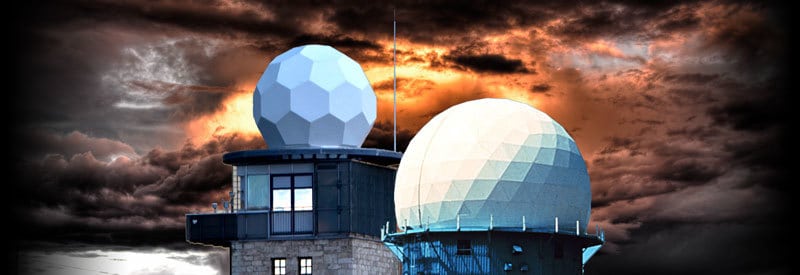
Many readers will be familiar with the different ways of collecting meteorological data, but some don’t always realize the importance of using radar technology. We take a closer look at the weather radar.
Radar technology has been around for some time, with its origins dating back to the late 1880s, when scientist Heinrich Hertz demonstrated that radio waves could be reflected off objects. The name is an abbreviation for the term “Radio Detection and Ranging.”
While using it to spot enemy aircraft during World War II, radar operators discovered that their systems were able to detect rainfall as well, which caused enemy targets to be obscured in many instances.
After the war, some systems continued to be used by scientists to experiment with the detection of precipitation. Over time, this led to the implementation of weather radars by governments and meteorological agencies worldwide.
This will be one of the main focus points of this article. The aim is to explain and illustrate precisely what a weather radar is, its characteristics, and how it is used for meteorological purposes.
What Is A Weather Radar?
Before delving into its characteristics and how it works, one first needs to define exactly what a weather radar is:
Weather Radar Definition
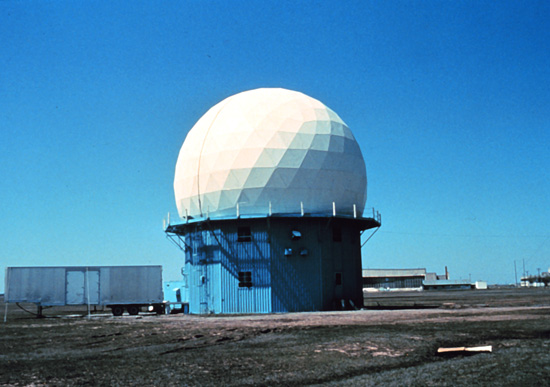
A weather radar is defined as a meteorological device, typically a pulse-Doppler radar, used to detect, image, measure the intensity of, and track the movement of precipitation. It does so by sending out microwave signals and analysing the returning echoes.
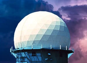
Imagine a giant golf ball sitting on top of a tee. You now have a pretty good idea what a weather radar looks like, as the accompanying picture clearly shows.
Weather radars come in different radome sizes and tower heights, depending on their specific purpose, the type of technology used, and the topography of the surrounding terrain.
The dome-shaped sphere, situated at the top of the tower, is called a radome. It houses the rotating antenna/dish, which is installed in the center of the dome.
How Does A Weather Radar Work?
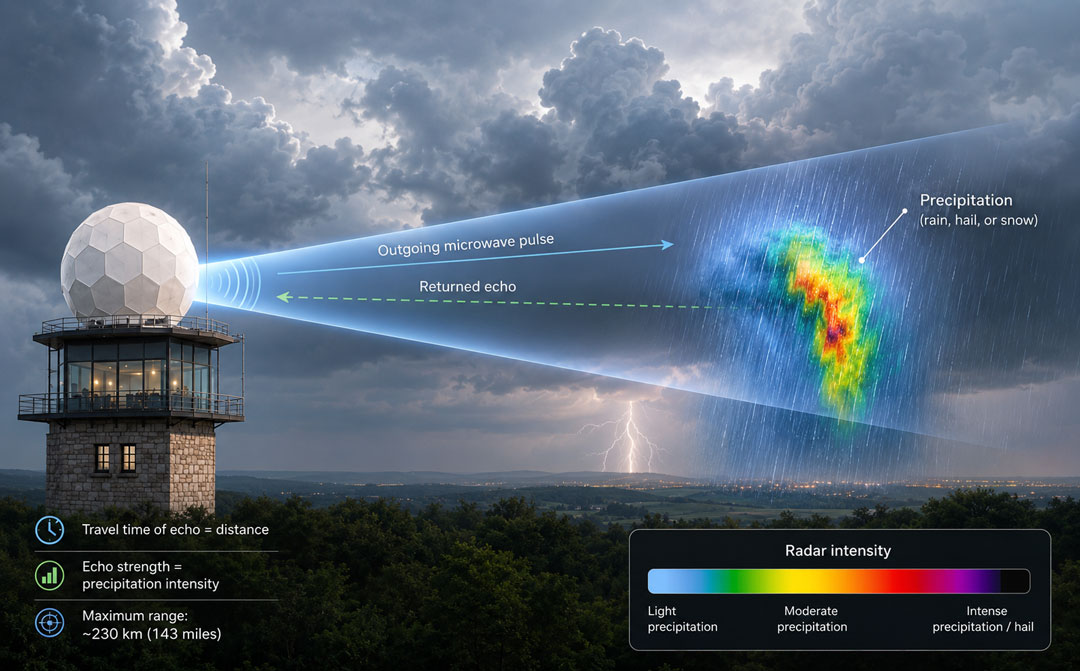
Diagram illustrating how a weather radar works. Click on the image for a larger view.
While rotating, the dish sends out microwave signals up to a distance of around 230 km (143 miles).
If the signal encounters any precipitation (rain, hail, or snow), it is reflected back to the radar tower, which interprets the reflected signal (also called the echo). The radar can determine a lot from the characteristics of the reflected wave.
The length of time it takes the echo to return to the sender indicates how far away the precipitation is from the radar. The strength of the echo, on the other hand, provides an indication of the intensity of the precipitation and, in some cases, the type encountered (rain, hail, or snow).
Although this varies from one radar to another, a weather radar normally completes a full scan every five to ten minutes. The resulting images are then combined to form an animated radar loop, often covering a period of around thirty minutes.
Although a radar image does not give you a clear and definite forecast, it shows you where the rainfall has been, as well as the direction in which it may be moving.
On modern-day weather systems, the results captured by a weather radar are displayed as a color image on a display screen.
A colour scale is used to show the intensity of the precipitation. The exact colours vary from one radar image to another, but the most intense precipitation is usually shown by the colours at the upper end of the scale. In some cases, black may represent hail.
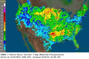 Color scales are also used to indicate the amount of rainfall, not just the intensity. The two terms are often used interchangeably, which can be confusing.
Be sure to read the weather scale that accompanies every radar image to confirm what each color means for that specific image.
Each radar image has a timestamp at the bottom of the image, which is usually shown in Coordinated Universal Time or UTC. This helps anyone viewing the picture to know when the image was created, no matter where in the world or in which time zone they are.
Limitations Of A Weather Radar
With all the advantages and benefits of weather radars, they are not without their shortcomings or limitations. Here are a few of the most notable drawbacks:
-
-
The effective range of a weather radar is limited to around 230 kilometres (143 miles), although this varies between systems. This is mainly due to the curvature of the Earth. As the radar beam travels farther away, it passes increasingly higher above the ground, making it more difficult to detect precipitation close to the surface.
-
As a result of the previous point, the radar may be able to pick up precipitation that is much higher up in the atmosphere beyond its effective ground-level range. This may not reflect the conditions at the surface, which can give a misleading reading as a result.
- It is difficult to pick up drizzle that is close to the ground, as it often falls below the radar’s beam, and the droplets are sometimes too small to detect (difficult to bounce back the signal).
-
A weather radar cannot detect echoes directly above the radar itself. This area is known as the “cone of silence.”
- Sometimes a radar can “falsely” pick up what is perceived to be precipitation, which is in reality flocks of birds, smoke, or swarms of insects.
- Radar beams cannot “see” through and are obstructed by permanent fixtures such as tall buildings and mountains. This is one of the main reasons why weather radars are located in large open areas.
-
The Doppler Weather Radar
Advances in radar technology have allowed us to add to the functionality of the conventional radar. The Doppler radar system is one such case. So, how does a Doppler radar work?
 A Doppler radar adds to the capabilities of traditional weather radar systems by measuring the movement of precipitation towards or away from the radar. This allows meteorologists to estimate wind speed and direction and, as a result, determine how the weather is moving. (Many modern weather radar systems are Doppler radars.)
It is capable of measuring wind direction and velocity by detecting changes in the frequency of the returning signal. It analyses how the movement of an object has changed this frequency. (This is called the Doppler effect.)
More specifically, it measures changes in the frequency of the returning signal. An object moving towards the radar causes the returning signal to have a higher frequency. An object moving away from the radar causes the returning signal to have a lower frequency.
In short, a higher frequency means an object (for example, rain) is moving towards the radar. A lower frequency means an object is moving away from the radar.
This ability is a very important function of modern weather radars implementing the Doppler effect. It allows meteorologists to determine the direction a weather system is moving in with a much greater degree of certainty.
In practice, it is used by organizers of outdoor events to better plan and adjust activities. It is also used in sports where weather plays a big role (like cricket and motorsport). Knowing if and how quickly rain will arrive has become a vital part of their planning and strategy.
Conclusion
It is clear to see how important the addition of weather radar systems is to the field of meteorology. Used alongside more traditional forms of weather detection, they help to produce much more accurate weather forecasts.
The addition of Doppler technology, which is now widely used in modern weather radar systems, has further enhanced the capabilities of weather radars. Weather radar information is also commonly used at many outdoor events where weather conditions play a crucial role.
Until next time, keep your eye on the weather!