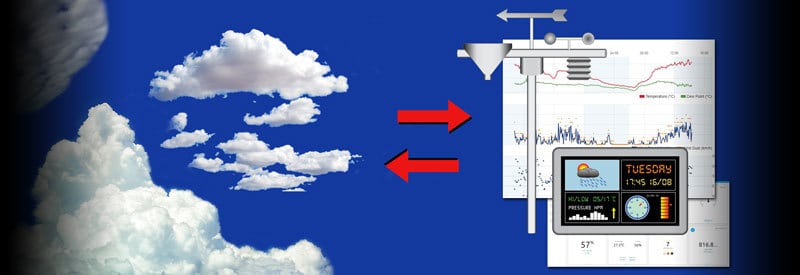
In today’s connected world, we have almost unlimited access to weather forecasts across different platforms. But by simply observing cloud formations, we can make our own short-term weather forecast.
And it is exactly this challenge we will be addressing in this article. By combining the power of thorough cloud knowledge with your weather station readings, you can be turned into a formidable forecaster of your local weather.
But let us not get ahead of ourselves. By concentrating on cloud identification first, then look at how you can combine this with your weather station in a later section, you will avoid any confusion and go through the process in a logical and orderly fashion.

In another article, we already discussed and explained the ten different cloud systems and the four categories under which each one falls. You can find the article here. (I suggest you keep this article open and nearby.)
You will quickly notice that some clouds look almost identical, and you may find it difficult to distinguish between some of them. In truth, some seasoned meteorologists still find it hard to make a clear distinction in some cases.
Luckily there are some steps you can take that will help you to make cloud identification much more simple. One technique that works very well and consists of a series of logical steps is the one we will focus on.
How To Tell Clouds Apart
By following a few simple steps, you will be able to identify the type of cloud you are looking at with some certainty. You may be surprised by how deceptively simple the process seems. However, the more you practice, the more accurate you will get.
The following steps are not foolproof but will go a long in helping you make confident cloud identifications. Here they are:
1) Determine The Shape Of The Cloud
By recognizing the shape of the cloud, you will immediately start to narrow down the wide selection of clouds. Pay attention and see if you can identify any of the following shapes following cloud shapes:
a) Puffy, Cotton-Like Or, Woolly Appearance
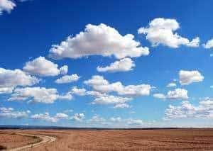
This shape is normally associated with different cumulus shaped clouds, often resembling balls of cotton. Examples include:
- Cumulus
- Cirrocumulus
- Altocumulus
- Stratocumulus
- Cumulonimbus
b) Layered In Appearance, Covering Large Areas Of The Sky
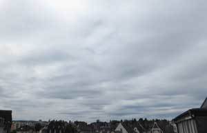
This shape clearly points to the featureless stratus-type clouds that appear at different heights in the atmosphere, which sometimes covers the entire sky from horizon to horizon. Examples include:
- Status
- Cirrostratus
- Altostratus
- Nimbostratus
c) Feathery Or Flaky Appearance
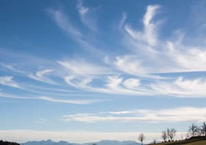
This is a common cirrus cloud-type shape, especially when the clouds are also very light in color. Examples include:
- Cirrus
- Cirrocumulus
- Cirrostratus
2) Note The Cloud Color
Although this rule is not set in stone, it gives a very clear indication of the state of the cloud you are observing.
A white or very light-colored cloud usually indicates a light cloud density, which means the moisture level is fairly low.
Think of the white cirrus clouds high up in the sky or the light-colored altostratus clouds that both have no precipitation associated with them.
In contrast, a gray to dark gray colored cloud usually indicates a high cloud density, which means the moisture level is very high.
When a low-lying stratus cloud thickens and turns into a nimbostratus cloud, it turns into a dark gray color. Similarly, a large cumulonimbus cloud typically has a dark gray base. Both these clouds are associated with heavy rainfall.
3) Determine The Height Of The Cloud
If you already read through the article describing the different cloud types, you will know that clouds are mainly categorized according to their height. If you need to refresh your memory, you can read the article here.
Height is also a great way to help you identify a specific type of cloud. I know it is not always easy to judge the height of a cloud, but you can get a good idea by looking at nearby objects.

- A flock of birds that quickly disappear in the clouds as they gain height will expose a low-level cloud very quickly.
- A cloud that covers the top of a relatively high mountainous area may point towards a medium-level cloud.
- When you observe a jetliner high in the sky, visible through feathery white clouds, sometimes leaving contrails in their wake, you are looking at high-level clouds.
These observations may seem trivial but can be crucial in making a final determination as to the type of cloud you are trying to identify.
4) Consider The Surroundings
When we talk about surroundings in this context, we refer to the atmospheric conditions surrounding the clouds.
This includes keeping an eye on variables like the wind, humidity, and temperature. (All these variables will be recorded and stored by your home weather station anyway, but in this context, you want to physically observe it to help identify a cloud type.)
While studying a cloud, make notes of any wind movements, changes in temperature, any rainfall, and other conditions you experience. Knowing what the conditions are like and what specific attributes a certain cloud has should help to eliminate any further confusion.
Important Note
Make sure you record all your observation when identifying clouds. Even a simple spreadsheet will do to capture all your observations and conclusions, as well as the date and time of each event.
This will be vital information to compare with your weather station data to form weather patterns and make accurate weather forecasts.
Using Your Home Weather Station
Modern home weather stations have more sensors than you’ll ever need. My own Ambient Weather Osprey station has ten sensors, but I seldom pay attention to more than five of them. I simply don’t need them.
If you are familiar with any of my other articles, you will know I consider the following three atmospheric variables the most important in any weather station. They are:
- Temperature
- Humidity
- Barometric Pressure
The importance of these three variables is simple.
- They are the most important indicators of future weather conditions, meaning weather forecasting.
- They also reflect why you experience the weather the way you do. (Feeling hot, uncomfortable, short-of-breath, etc.)
It is absolutely vital that you also record and store your weather station’s readings, as you will need them in the future to compare with your cloud observations, as I will explain in the next section.
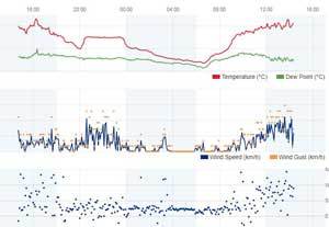
Luckily, keeping track of these variables is a simple process with modern weather stations. The majority of them connect to their own or third-party online servers that record and store all sensor readings after a proper setup.
Apart from the three weather variables I singled out, two other variables are also useful and important for the sake of this article’s subject matter. They are wind (speed & direction) and rainfall.
You can get more in-depth information about a weather station’s different weather sensors, what they measure, and how they work in this article.
Now it’s time to find out why and how cloud knowledge and your home weather station work together to establish local weather patterns and make better forecasts.
Putting It All Together
If you are a home weather station owner, you probably already know that your home weather station’s “weather forecast” is often not very accurate. It also differs substantially from the local or regional weather forecasts in many cases.
(If you are very lucky, your weather station’s forecasts may be reliable and accurate and also correlate with local and regional forecasts. This is seldom the case, though.)
There are a couple of good reasons for this discrepancy:
- Your local area (neighborhood) has its own micro-climate that may differ from the general regional weather conditions.
- Your weather station also measures different variables in your area than that which are measured by a bigger professional weather station on a larger scale.
- Lastly, the range of your home weather station sensors is much more limited than those used by professional weather stations that can measure atmospheric conditions hundreds of miles away.
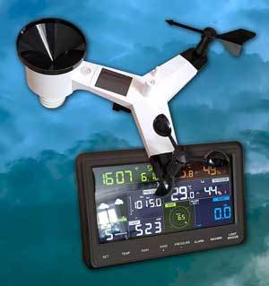
For these reasons, it is perfectly understandable why the best personal weather station money can buy will battle to make an accurate weather forecast (using its presets and making comparisons with local forecasts). Luckily it’s not that hard to solve the problem.
You simply need to learn what measurements on your home weather station lead to certain weather conditions in YOUR area. In other words, you need to establish a weather pattern that is unique to your area.
And this is here where your cloud observation and weather station data come in.
Combining Your Cloud Observation Data With Your Weather Station To To Make Better Forecasts
The procedure is very simple. You can learn to recognize this pattern with consistent practice. (More on this “on the fly” exercise a little later.)
Even better, you can take the time to sit down and do a proper analysis of the data. Simply follow these steps:
- Sit down and study a record of cloud observation data over a specific period of time. (Preferably for at least a period of 12 months to have enough data to work with.)
- Mark the areas where notable weather events took place (like heavy rainfall, very cold or hot temperatures, storm systems, etc.)
- Now make a record of your home weather station’s sensor data for the same period of time.
- Make a note of what the different weather sensors measured before or during each notable weather event you marked.
- Pretty soon, you will start to start to see a pattern emerging as you look at your weather station’s measurements that preceded and accompanied every weather event, as well as what type of cloud was present during this period.
You can confirm this pattern by looking at a certain weather event, like rainfall, whenever it occurred. If the same weather station readings repeatedly preceded this event, you have an established pattern.
If the same cloud system also preceded the same type of weather event in the majority of cases, this can be seen as further proof of the already established pattern.
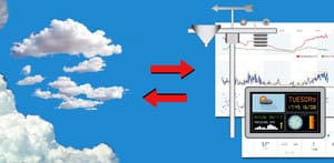
And there you have it. You are now able to determine what kind of weather to expect when your weather station measures a certain combination of readings.
If the clouds you see correlates with your station’s readings (as established when you were comparing and formulating the weather pattern for your area), it will serve as further confirmation that you can expect a certain type of weather.
“And this is exactly How you can Predict The Weather by observing the clouds Together With using Your Home Weather Station”
It looks a little daunting, I know. However, by keeping a thorough record, and going through these steps a couple of times, will help you master the process more quickly than you think.
Using “On The Fly” Consistent Practices
At the beginning of this section, I recommended constant practice to learn to use the clouds and your weather station together to make an accurate weather prediction.
You may not want to wait a year to gather enough data to study, make comparisons and form your own system of weather forecasting.
You can simply keep your eye out for any cloud development and look at what your station’s readings are at the same time. Then you obviously need to make a note of what the resulting weather conditions are.
By doing this repeatedly, you will start to see similarities between cloud developments, certain weather station readings, and the resulting weather.
This method of “learning as you go” is one way of learning to “read” the weather by constantly observing clouds and sensor readings.
This needs to be tested and confirmed over time, though, and it here where the 5 step method I described above comes into play.
Conclusion
This article turned out to be a bit more “technical” than I intended, but it is the best possible way of helping you make use of the resources at your disposal to establish weather patterns and create accurate weather forecasts for your little corner of the world.
As any professional meteorologist or weather service provider will tell you, your forecasting system will never be foolproof, and nature will do its best to create confusion and make you doubt your methods.
You will find yourself constantly tweaking your “system” as you learn more and additional data comes available. Welcome to the never-ending world of meteorology!
However, you will keep on improving as time goes by, and things definitely won’t get boring. Our unpredictable weather will make sure of that.
Never miss out again when another interesting and helpful article is released and stay updated, while also receiving helpful tips & information by simply clicking on this link .
Until next time, keep your eye on the weather!

