What Is A Weather Satellite – The Different Types Of Weather Satellites And How They Work

Over 8000 artificial satellites are currently orbiting our Earth, of which 4853 are still active. They serve a wide range of purposes, including the study of our atmosphere for which weather satellites are used.
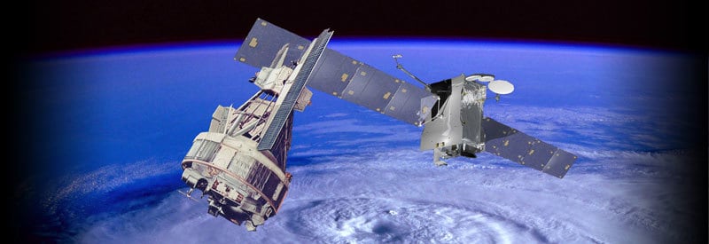
A weather satellite is an artificially created object orbiting the Earth in Space with the primary purpose of measuring and collecting meteorological data from a range of atmospheric conditions. It remains in Low Earth Orbit or is placed in a fixed position over the equator in Geostationary Orbit.
Although it's hard to pinpoint the precise amount of active weather satellites in orbit right now, it's a significant number, and new ones with more advanced and accurate measuring equipment get launched on a regular basis.
Over the past few decades, meteorological satellites have become an indispensable part of meteorology. Not only are they used to help make accurate weather predictions and create forecast models, but they also track important weather events (like hurricanes) in realtime.
This article examines what a weather satellite is, how it works, and also takes a look at the different types of weather satellites.
What Is A Weather Satellite?
A number of countries currently have multiple weather satellites in space to monitor the weather and climate, including Japan, The United States, China, Europa, and Russia.
Before examining them in more detail, we first need to clarify what a weather satellite is.
Weather Satellite Definition

A weather satellite is an artificially created object orbiting the Earth in Space with the primary purpose of measuring and collecting meteorological data from a range of atmospheric conditions. It remains in Low Earth Orbit or is placed in a fixed position over the equator in Geostationary Orbit.
Rain, snow, ice, fire, cloud systems, dust storms, air pollution, volcanic ash, and ocean currents are just some of the many parameters that a weather satellite measures.
All the data collected by these satellites get sent back to Earth, where meteorologists and climatologists use it to monitor current atmospheric conditions, predict future weather events, and create or refine forecast models.
How Do Weather Satellites Work?
The essential workings of a weather satellite are not much different from other types of earth-orbiting satellites. The most significant difference is the type of equipment it carries onboard and its unique orbits and positioning around the Earth.
Before one can look at what sets weather satellite apart from other satellites, we need to look at the features that all satellites have in common and makes them work.
Components Of A Satellite
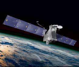
Almost all earth-orbiting satellites have basically the same make-up. The majority of satellites have the following make-up that they need to function:
- Main Body: Containing instrumentation, fuel, solar batteries, communication hardware, etc.
- Solar Panels: Providing power to all onboard instrumentation, sensors, navigation equipment, etc.
- Rockets: The propulsion system using onboard fuel to make small orbital adjustments and minor maneuvers.
- Antennas & Transponders: The crucial equipment for communicating with the ground and the ability to be tracked and located.
- Thermal System: For protecting electronics and sensitive equipment from the extreme heat and cold temperatures in space.
Several other components also form part of the make-up of a satellite. For example, the aluminum covering protects external equipment from solar radiation. These components, though, do not make up the crucial parts of a satellite.
How Do Satellites Stay In Orbit?
A satellite stays in orbit by balancing two parameters: Speed (velocity) and Gravity.

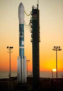
Before a satellite can establish its orbit around Earth, though, it needs to get into space first. To accomplish this, they need a rocket that is powerful enough to break free from the planet's gravitational forces and carry the satellite into its designated orbit.
A rocket needs to reach speeds of at least 28 000 km/h (17 500 mph) to overcome the Earth's gravity and thick atmosphere. Once it clears the strongest gravitational forces, it can carry the satellite in low, medium, or high orbit.
(Learn more about rockets and how they work in this article.)
Once the predetermined orbit is reached, the satellite gets released at the right orbit speed to maintain the same height above Earth's atmosphere. This speed was calculated to balance the satellite's velocity with Earth's gravity to maintain a constant altitude.
The satellite's speed needs to be fast enough not to get dragged down by the planet's gravity, yet slow enough to not completely break free from all gravitational forces and travel straight into space.
In this way, a satellite can stay in orbit around Earth's surface for decades and even make small adjustments in its orbit by using the small amount of fuel it carries onboard.
What Makes A Weather Satellite Different
A weather satellite may look like any other satellite, but it is its imaging equipment it carries onboard that sets it apart. The high-resolution imagers (cameras) are able to capture images in the visible, near-infrared, and infrared (thermal) range of the solar spectrum.
The range of atmospheric and surface parameters that can be measured, are literally too numerous to mention. For example, NASA's geostationary satellite, GOES-16, is capable of taking high-resolution images with 16 spectral bands. They include 10 infrared, 4 near-infrared, and 2 visible channels.
What this means is that satellites like the GOES-16 can capture detailed images of a wide range of parameters in the atmosphere, from cloud formation, land surface temperature, ocean currents, and even aerosols and vegetative health.
The images get sent back to ground stations where meteorologists, environmental agencies, etc., can access them. They use for accurate weather predictions, do impact studies, conduct meteorological risk assessments, and refine climate models, to mention just a few.
The images and data that gets captured come from two types of weather satellites that are classified according to their orbit around Earth, which will be discussed in the next section.
Polar And Geostationary Satellites
The two different types of weather satellites are categorized according to their orbit around Earth, which is either a geostationary or polar orbit. Each one has its own advantage and actually compliment each other.
Polar-Orbiting Satellites
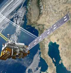
Polar-orbiting weather satellites orbit the Earth around the North and South Poles. They get placed in a low orbit of around 850 km (530 miles) above the planet.

The low orbit allows a satellite to cover every location on Earth and image the same area twice a day. The ability to cover the entire planet frequently at low orbit allows polar-orbiting satellites to get a much more detailed look at the surface and atmosphere at any given time.
The latest generation of these satellites is especially well-equipped to measure specific aspects of weather like atmospheric temperatures, various cloud parameters, as well as, humidity fields.
Like geostationary satellites, most major nations have their own polar-orbiting series of satellites. The United States makes use of their NOAA range of satellites, Russia operates the Meteor series of satellites, and Europe uses the Metop satellites.
Geostationary Satellites
Geostationary satellites orbit the Earth at altitudes of around 35 880 kilometers (22 300 miles), much higher than any polar-orbiting weather satellite. The vast distance from the planet's surface enables the satellites to take images of Earth's entire hemisphere at a time.
This ability helps meteorologists to get a global picture of atmospheric and surface conditions. Earlier in this article, you saw the broad spectrum of channels a geostationary satellite can use to monitor multiple meteorological conditions (in the form of the GOES-16.)
A geostationary satellite also orbits around the Equator at the same frequency the Earth rotates, which means the satellite always remains in one location above the planet.
One of the many advantages that this type of orbit provides is that a ground station can place a directional antenna in a fixed position, and it will stay in communication with the geostationary satellite without continuous adjustments.
Like polar-orbiting satellites, major nations of the world use their own group geostationary satellites. The United States uses the GOES series of satellites, Russia the Elektro-L, Japan the Himawari, and Europe operates the Meteosat range of satellites.
Conclusion
This article not only described weather satellites but the workings of satellites in general. This is necessary, as weather satellites use basic satellite design and operation to function.
One needs to understand how weather satellites operate in principle before one can focus on the instrumentation and positioning that make them unique.
And this is precisely what this article aimed to accomplish: Describe what a weather satellite is and how it works. And then, continue to describe what makes these satellites different and highlight the different types of weather satellites.
Never miss out again when another interesting and helpful article is released and stay updated, while also receiving helpful tips & information by simply clicking on this link .
Until next time, keep your eye on the weather!

