by Wessel Wessels | Jan 7, 2020 | General
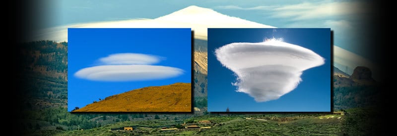
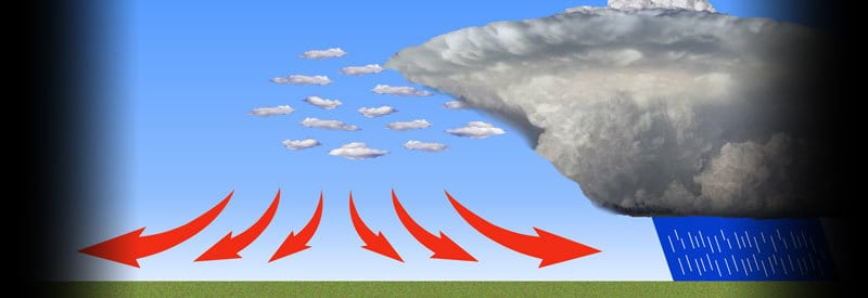
Cap Clouds – What They Are And How They Differ From Lenticular Clouds Cap Clouds – What They Are And How They Differ From Lenticular Clouds Cloud development primarily results from atmospheric conditions like wind, temperature, and moisture. Certain clouds, though,...
by Wessel Wessels | Jan 2, 2020 | General
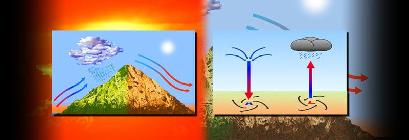
Defining The Adiabatic Process – What It Is And How It Occurs Defining The Adiabatic Process – What It Is And How It Occurs The various processes at work in our atmospheric air are crucial to weather formation and impact most meteorological events. The adiabatic...
by Wessel Wessels | Dec 29, 2019 | General
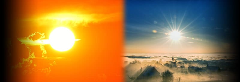
The Warmest And Coldest Time Of The Day – When They Occur And Why The Warmest And Coldest Time Of The Day – When They Occur And Why A common misconception exists among readers that the warmest time of the day occurs during midday, while the warmest occurs at midnight....
by Wessel Wessels | Dec 22, 2019 | General
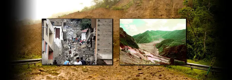
Huaycos - What They Are, How They Occur, And Their Impact On Human Activity Cap Clouds – What They Are And How They Differ From Lenticular Clouds In the Tropics, an event known as a huayco can cause large-scale destruction and devastation. Although different, its...
by Wessel Wessels | Dec 14, 2019 | General
Defining A Heat Burst – What It Is And How It Occurs Defining A Heat Burst - What It Is And How It Occurs A rare event, characterized by an unexpected gust of warm, dry wind originating seemingly out of nowhere, occurs under certain conditions during a warm summer...
by Wessel Wessels | Dec 9, 2019 | General
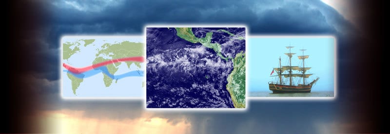
The Doldrums - Defining The Intertropical Convergence Zone The Doldrums – Defining The Intertropical Convergence Zone Some readers may be familiar with the saying “in the doldrums,” referring to a person feeling “down” or depressed. But the...