Defining Cap Clouds – What They Are And How They Form

Cloud development primarily results from atmospheric conditions like wind, temperature, and moisture. Certain clouds, though, form due to topographical variations on the planet's surface, like cap clouds.
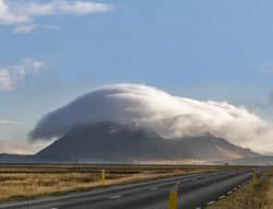
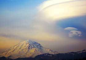
Cap or Pileus clouds are defined as stationary orographic clouds that form over a mountain peak when moist air is forced up the windward slopes, and condensation occurs as it flows over the top. Unlike lenticular clouds, they form directly over a mountain or high hilltop and have a dome-like shape.
Variations on the planet's surface influence a variety of meteorological occurrences like wind, temperature, and, yes, cloud formations. Especially elevations and dips on the surface play a significant role in the development of certain clouds.
One type of cloud that is a direct result of the physical elevation in terrain is called a cap cloud. In this post, we look at what cap clouds are, how they form, and how they differ from the more familiar lenticular clouds.
Cap Cloud Definition
As mentioned in the introduction, a cap cloud is the result of a change in physical terrain, but this is not the only factor at play in the formation of this cloud system.
Before looking into how a cap cloud is formed, one must first define what precisely it is and describe its characteristics in more detail:
What Is A Cap Cloud?

Cap or Pileus clouds are defined as stationary orographic clouds that form over a mountain peak when moist air is forced up the windward slopes, and condensation occurs as it flows over the top. Unlike lenticular clouds, they form directly over a mountain or high hilltop and have a dome-like shape.
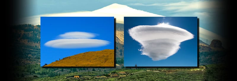
This cloud is characterized by its unique mushroom or upside-down saucer shape and can always be found over the top or above a mountain peak.
It is not that uncommon to see two cap clouds on top of each other, hovering over the same mountain top. It occurs typically when a layer of dryer air separates two layers of moist air.
How Cap Clouds Form
Cap clouds form as a result of orographic cooling (which is part of the Orographic Effect). As prevailing winds push moist air against a raised terrain like a mountain, it forces the layer of air to rise against the slopes.
As the air rises, it starts to cool down. It continues to cool down until it reaches dew point, and condensation takes place near the top of the mountain. As a result, the air flowing over the mountain top creates the flat, dome-shaped cloud that is the trademark of a cap cloud.
The raised terrain not only causes the air to rise on the windward side of the mountain, but as it starts to descend down the leeward slopes, it also creates a wave in the airflow. And it is here where lenticular clouds come into play.
Lenticular Cloud Definition
The wave formed in the wake of the air lifted over an elevated terrain forms the foundation for the occurrence of lenticular clouds.
As with cap clouds, one first needs to get a clear understanding of the definition of a lenticular cloud before looking into how these clouds develop:
What Is A Lenticular Cloud?

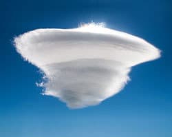
A lenticular cloud, characterized by its saucer-like shape, is a stationary cloud that forms in the troposphere on the leeward side of a mountain. It forms on the crest of a wave that results from air forced to lift over raised terrain. Its alignment is perpendicular to the direction of air movement.
As mentioned in the description, lenticular clouds form at a high altitude in the troposphere. This is mainly due to the elevated terrain, specifically mountains, that is responsible for creating the conditions favoring the formation of these clouds.
A few elements need to be in place to form the ideal conditions for lenticular clouds to occur. The creation of wave movement on the leeward side of a raised terrain is the crucial element in the formation of these clouds.
The saucer or lens-like shape is another unique characteristic of lenticular clouds. Since it does not appear close to the surface, it is not often visible from the ground. As a result, it is often mistaken for a UFO (Unidentified Flying Object) or another artificial object.
The layered (pancake) shape of the cloud is the result of multiple layers of cold air reaching dew point at the crest of downwind waves. The crucial role these downward waves play in the formation of lenticular clouds will become evident in the next section.
How Lenticular Clouds Form
For a lenticular cloud to form, three elements need to be present and in place:
- Adequate Moisture In The Air
- Prevailing Wind
- Formation Of A Wave In The Air Movement On The Leeward Side Of A Mountain
As mentioned earlier, it is this wave of air that is primarily responsible for the formation of a lenticular cloud.
After the formation of a cap cloud, the air that is lifted on the windward side of a raised terrain dips on the leeward side. More importantly, it creates a continuous wave in the air moving downwind.

The wave consists of a series of crests and troughs continuing downwind. When moist air reaches the crest of a wave and the temperature drops below dew point, condensation takes place, which allows for the development of a lenticular cloud.
When the prevailing wind persists, the crests and troughs in the wave of air continue to form downwind, which can result in a series of lenticular clouds forming. These formations are better known as wave clouds.
The clouds seem to remain stationary, but there is a constant flow of air through them. The reason they "stay in place" is that the air dips below dew point at the crest of the wave, allowing the cloud to form. When the wave dips down, it evaporates as the air warms up.
Difference Between Cap Clouds & Lenticular Clouds
What will have become evident during the description of cap and lenticular clouds is that their formation is almost identical. The only difference is that a lenticular cloud forms on the wave of air created due to forced elevation on the leeward side of a mountain.
Several articles and papers clearly state that cap clouds are actually lenticular clouds due to the almost identical formation process and similar cloud shape. Technically, this statement is correct, and a cap cloud can be classified as a lenticular cloud.
However, from a practical standpoint, and when described in layman's terms, there are subtle but significant differences between the two that can be summarized as follows:
- While cap clouds occur directly over a mountain peak, lenticular clouds usually form on the leeward side of the mountain.
- Cap clouds have a flat, dome-shaped form, while lenticular clouds have a layered or stacked shape in the form of a lens or saucer.
As already stated, these are subtle but significant differences.
Conclusion
It is clear that there can be some confusion when discussing cap clouds and lenticular clouds, and why they are often seen as the same type of formation. This post managed to highlight the small but notable differences between the two.
The aim of this article was to explain what cap clouds are, how they form, and how they differ from lenticular clouds in formation and shape.
Never miss out again when another interesting and helpful article is released and stay updated, while also receiving helpful tips & information by simply clicking on this link .
Until next time, keep your eye on the weather!
