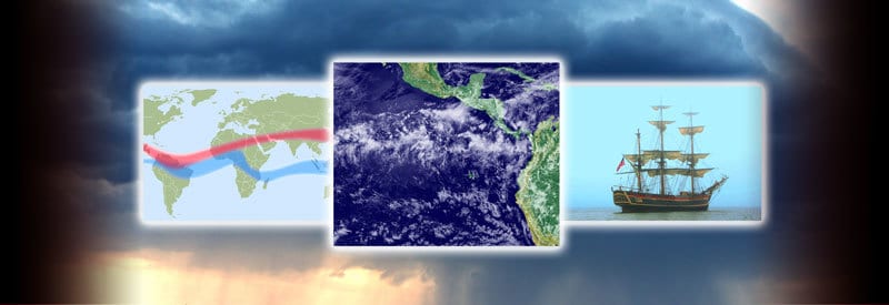
Many older readers may be familiar with the saying “in the doldrums,” referring to a depressed person. But the doldrums actually refer to a specific region with weather conditions dreaded by ancient mariners.
The doldrums primarily refer to the Intertropical Convergence Zone, a calm, windless region close to the Equator where the northeastern and southeastern trade winds converge and collide. Sailors used the term during the 19th century to describe this part of the ocean with little to no wind activity.
Actually, it dates back as far as the mid 19th century when this nautical term originated with sailors of the time when they used it to describe their predicament when their ships came to a stop and were unable to make any progress for days or even weeks on end.
We take a close look at what precisely the doldrums are, how they occur, and look at some of their main characteristics.
Doldrums Definition
During the introduction, you already got a glimpse of what the doldrums are, but the description is vague and needs a more thorough and precise explanation. Before delving into the details, though, it is important to define the term first to lay the foundation:
What Are The Doldrums?

The doldrums refer to the Intertropical Convergence Zone, a calm, windless region close to the Equator where the northeastern and southeastern trade winds converge and collide. Sailors used the nautical term during the 19th century to describe this part of the ocean with little to no wind activity.
“The doldrums” is an old nautical term used by sailors during the 19th century to describe the part of the ocean where their sailing ships got stuck and were unable to make much progress due to the lack of wind.
It is clear from the definition that the doldrums is a location (the Intertropical Convergence Zone) and not a situation, as the introduction implied. It may sound a bit confusing, but as you will soon learn, this is simply a result of miscommunication during the 19th Century.
Needless to say, there was no radio or any other modern form of direct communication during this period. As a result, communication between ships and their headquarters thousands of miles away had to be relayed via written word or simple “word of mouth.”
As a result, when reports reached officials on the mainland, describing the conditions they experienced as being “in the doldrums,” it was misinterpreted as the sailors describing an actual location called the doldrums.
Without the misunderstanding corrected, a president was set, and the rest, as they say, is history. Today, the Intertropical Convergence Zone (ITCZ) is still commonly referred to as the doldrums.
How The Intertropical Convergence Zone Is Formed
As mentioned in the description, the Intertropical Convergence Zone (ITCZ) develops where the northeastern and southeastern trade winds meet at the thermal equator. (The thermal equator is not a fixed position on the planet’s surface, but more on that in the next section.)
The ITCZ moves with the thermal equator as it shifts around 5 degrees north and south of the physical equator throughout the year. (For easier reading, the Intertropical Convergence Zone will be referred to as the ITCZ or doldrums for the remainder of this article.)

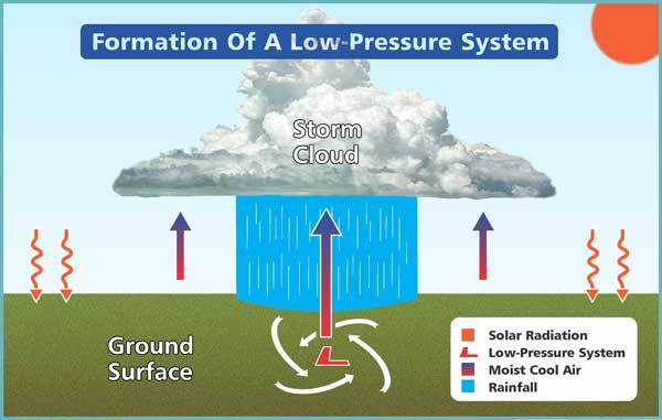
The formation of a high-pressure system in the ITCZ. Click on the image for a larger view.
The sun heats the surface of the land and sea at the thermal equator, causing it to warm the air directly above the surface. As the air warms and expands, it starts to rise, creating an area of low pressure at the surface. (Learn more about low-pressure systems in this article.)
The southern and northeastern trade winds approach each other and converge at the thermal equator. As they encounter the low-pressure system and rising air in the region, these stop moving in a horizontal direction and start to move vertically with the rising air.
As a result, there is almost no horizontal air movement remaining at the surface, and the little wind present is highly erratic. It is these windless conditions that form the ITCZ, more commonly described as the doldrums by the mariners of the 19th century.
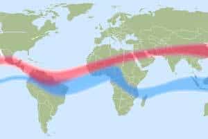
This band of low-pressure and relatively windless conditions, called the ITCZ or doldrums, encircles the entire planet and follows the thermal equator as it meanders to the north and south throughout the year.
Features Of The Intertropical Convergence Zone
With a clear understanding of how the ITCZ or doldrums develops, it is also beneficial to be aware of the different characteristics that this weather phenomenon displays. The most notable of these have already been touched on, but need to be explained in more detail:
- Shifting Position
- Low-Pressure System
- Large Amounts Of Humidity And Rainfall
- Very Little And Erratic Air Movement
By looking at each characteristic individually, it will be easier to understand and see how it fits into the larger mechanism that drives the ITCZ.
1) Shifting Position
Throughout the year, the ITCZ moves with the thermal equator as it shifts around 5 degrees north and south of the geographical equator. This movement is closely related to the seasonal movement of the sun.

As a result, the ITCZ moves north during the summer months in the Northern Hemisphere and reaches its furthest point during July/August. It then returns south and crosses into the Southern Hemisphere, reaching its most southern position around January/February.
This is a very general description of the movement of the ITCZ. Its actual motion is more complex, and its position can shift unexpectedly over some regions. It can also remain over an area or stay away from it for extended periods with potentially devastating results.
Another variable that influences the movement of the ITCZ is the fact that the ground surface warms up more quickly than the ocean’s water when exposed to solar radiation. It results in the ITCZ extending further over land than the sea at the same latitude.
Countries within the Tropics rely on the rainfall that occurs with the arrival of the ITCZ, which means that they can be severely affected by an unnaturally long stay or absence.
During a prolonged absence, a region may experience severe drought, depending on the length of time the ITCZ stays away. When this occurrence remains over an area for an abnormally long period, however, the large amount of rain can lead to widespread flooding.
2) Low-Pressure System
Although this post already briefly mentioned the development of a low-pressure system, a more elaborate explanation is needed to understand its importance.
The planet’s surface at the Tropics receives more direct and intense solar radiation from the sun than any other part of the world. As a result, both the ocean and land surface get extensively warmed up.
In turn, the surface heats the air directly above it. As the air gets warmer, it expands and becomes less dense than the surrounding cold air. This leads to the lighter layer of air starting to rise, which leaves an area of intense low pressure near the ground.
The importance of this powerful low-pressure system can not be emphasized enough. It is this weather condition that forces the air from the approaching trade winds to be sucked up in the strong vertical lift, which disrupts its horizontal movement.
3) Large Amounts Of Humidity And Rainfall
If you look at a satellite image of the Earth, the ITCZ can easily be identified by the band of clouds encircling the planet near the Equator. It represents the high humidity that forms the numerous rainclouds and thunderstorms occurring in this part of the world.

The high temperatures at the surface in the Tropics, combined with an abundance of water sources, leads the air to be saturated with moisture. As the moist air starts to rise and gain altitude until it reaches dew point, and condensation takes place.
The resulting storm clouds that form contain a large volume of water droplets. When it can no longer carry them, a burst of intensive and heavy rainfall follows. Although the rain does not last long, a large amount of water gets released in a very short period of time.
It is these short, intense rain showers that are so typical of the weather produced in the Intertropical Convergence Zone.
4) Very Little And Erratic Air Movement
It has been mentioned numerous times throughout this article, but as it is the primary reason for this article and the reason the term doldrums exists, it is worth noting again.
The most well-known characteristic of ITCZ is the absence of wind or very little and erratic air movement. The reason for this phenomenon has already been thoroughly explained.
It is also important to note that even modern sailing boats, no matter how technologically advanced, still battle to make progress and attempt to avoid getting caught in the clutches of this windless region at any cost.
Conclusion
Even though the saying “in the doldrums” may become a bit outdated, it is still used across the world without knowing the real origin of the term.
By now, there should be no confusion or doubt as to where the term, the doldrums, originated. Whether you want to refer to it as the doldrums or the Intertropical Convergence Zone, the dangerous windless conditions that define them remain ever-present.
Never miss out again when another interesting and helpful article is released and stay updated, while also receiving helpful tips & information by simply clicking on this link .Until next time, keep your eye on the weather!

